Show the map
La Onzainoise - 24 km
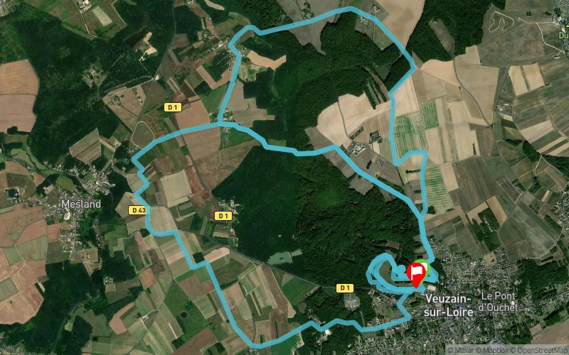


23 km
610 m
600 m
 Onzain (41)
 Onzain (41)
 Points of Interest table
| Accum. | Intermediary | |||||||
|---|---|---|---|---|---|---|---|---|
| POI | Description | Alt. | Dist. | D+ | D- | Dist. | D+ | D- |
 Competition organized on 09/16/2018
Trace n°63573
Ascent threshold : 3 m Distance threshold : 30 m Smoothing : Yes Origin of altitudes : MNT Aster GDEM
Ascent threshold : 3 m Distance threshold : 30 m Smoothing : Yes Origin of altitudes : MNT Aster GDEM
Loop
Dominant terrain : Path
Max alti. : 132 m
Avg alti. : 95 m
Min alti. : 0 m
Longest ascent : 80 m
Longest descent : 60 m
Dominant terrain : Path
Max alti. : 132 m
Avg alti. : 95 m
Min alti. : 0 m
Longest ascent : 80 m
Longest descent : 60 m
Elevation profile
More tools
Create a new roadbook page
Map and track on your website
Warning ! When you insert a Trace de Trail map on your website, you agree not to hide any element of the module (links to Trail Trail or Trail Connect banner)
Add a realisation
Validate
Add a realisation to share your chrono and describe the conditions that you encountered during you trail running !
Add a comment
Validate
Etiniant
22/08/20, 12:30:59
Bonjour, Merci pour la trace. Je pense qu'il y a une erreur sur le dénivelé. Etienne
22/08/20, 12:30:59
Bonjour, Merci pour la trace. Je pense qu'il y a une erreur sur le dénivelé. Etienne
Show the infos
Add a track


