Show the map
Dolce Via - Fontbonne - Chambaud
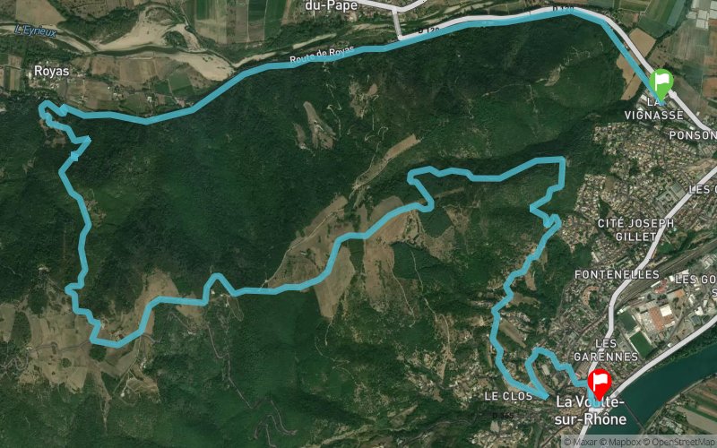


14 km
470 m
480 m
 Beauchastel (07)
 La Voulte-sur-Rhône (07)
 Points of Interest table
| Accum. | Intermediary | |||||||
|---|---|---|---|---|---|---|---|---|
| POI | Description | Alt. | Dist. | D+ | D- | Dist. | D+ | D- |
Trace n°60974
Ascent threshold : 3 m Distance threshold : 0 m Smoothing : No Origin of altitudes : GPS
Ascent threshold : 3 m Distance threshold : 0 m Smoothing : No Origin of altitudes : GPS
Crossing
Dominant terrain : Footpath
Max alti. : 413 m
Avg alti. : 231 m
Min alti. : 94 m
Longest ascent : 340 m
Longest descent : 380 m
Route completed by the author : No
Dominant terrain : Footpath
Max alti. : 413 m
Avg alti. : 231 m
Min alti. : 94 m
Longest ascent : 340 m
Longest descent : 380 m
Route completed by the author : No
Elevation profile
More tools
Create a new roadbook page
Map and track on your website
Warning ! When you insert a Trace de Trail map on your website, you agree not to hide any element of the module (links to Trail Trail or Trail Connect banner)
Add a realisation
Validate
Add a realisation to share your chrono and describe the conditions that you encountered during you trail running !
Add a comment
Validate
Show the infos
Add a track


