Show the map
Chalet de l'Aulp - Col des Nantes - Col des Frêtes
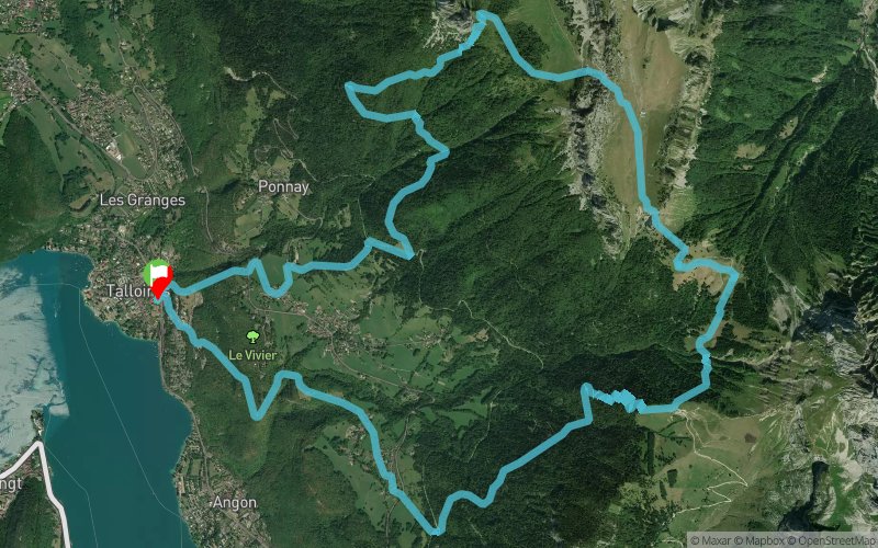


17.6 km
1430 m
1430 m
 Talloires (74)
 Points of Interest table
| Accum. | Intermediary | |||||||
|---|---|---|---|---|---|---|---|---|
| POI | Description | Alt. | Dist. | D+ | D- | Dist. | D+ | D- |
Trace n°58610
Ascent threshold : 3 m Distance threshold : 30 m Smoothing : Yes Origin of altitudes : MNT Aster GDEM
Ascent threshold : 3 m Distance threshold : 30 m Smoothing : Yes Origin of altitudes : MNT Aster GDEM
Loop
Dominant terrain : Footpath
Max alti. : 1662 m
Avg alti. : 1101 m
Min alti. : 478 m
Longest ascent : 1420 m
Longest descent : 1190 m
Route completed by the author : nc
Dominant terrain : Footpath
Max alti. : 1662 m
Avg alti. : 1101 m
Min alti. : 478 m
Longest ascent : 1420 m
Longest descent : 1190 m
Route completed by the author : nc
Elevation profile
More tools
Create a new roadbook page
Map and track on your website
Warning ! When you insert a Trace de Trail map on your website, you agree not to hide any element of the module (links to Trail Trail or Trail Connect banner)
Add a realisation
Validate
Add a realisation to share your chrono and describe the conditions that you encountered during you trail running !
Add a comment
Validate
liszto
13/05/18, 16:54:11
@charline2603 merci pour le retour, je m'étais créer la trace pour une rando trail, je n'ai pas pu la tester pour le moment. Désolé pour les approximations de sentiers par endroit :(
13/05/18, 16:54:11
@charline2603 merci pour le retour, je m'étais créer la trace pour une rando trail, je n'ai pas pu la tester pour le moment. Désolé pour les approximations de sentiers par endroit :(
Show the infos
Add a track


