Show the map
Certified Track - ITRA
Orjenski ?ir 2017


 Dubravka (ME)


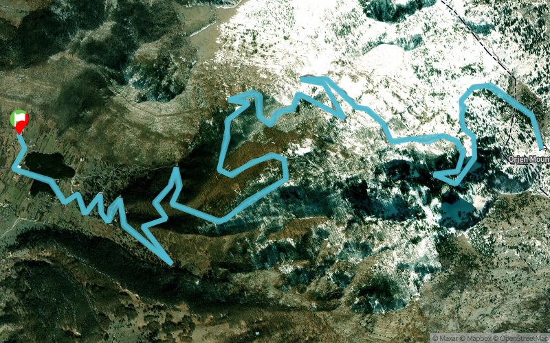
The third “ORJENSKI DJIR” will be held on Saturday, October 10, 2017. As the organizers of the race, we are here again - the proven team of NVO “ORJEN OUTDOOR” and AK “NISKOGORCI”crews. Turist Organization “Herceg Novi” joins us this year as the general sponsor of the race and “LAZURE” Marina & Hotels are here as a sponsor and friend of the race. AND THIS YEAR AGAIN WE ARE OFFERING TWO RACES IN TWO DISTANCES!!! The first one, VELIKI DJIR (BIG DJIR), is for all real lovers of trail running and during the race we will try to bring all participants closer to pristine parts of Orjen mountain. The race is approximately 28 km long, with an elevation gain of 1900 m and it will include the Orjen’s highest summit at Veliki Kabao 1894 masl and the Orjen’s most beautiful summit at Subra 1679 masl. The second race is MALI ?IR (SMALL DJIR), with a shorter distance of 15 km and approximately 1000 m of total elevation gain. WE PROMISE YOU GREAT FUN AT ORJEN!!!
All info available at https://orjenskidjir.wordpress.com/
Registration https://www.stotinka.hr/hrv/dogadjaj/466
Points of Interest table
| Accum. | Intermediary | |||||||
|---|---|---|---|---|---|---|---|---|
| POI | Description | Alt. | Dist. | D+ | D- | Dist. | D+ | D- |
 Competition organized on 10/07/2017
Trace n°45815
Ascent threshold : 3 m Distance threshold : 0 m Smoothing : No Origin of altitudes : GPS
Ascent threshold : 3 m Distance threshold : 0 m Smoothing : No Origin of altitudes : GPS
Loop
Dominant terrain : Footpath
Max alti. : 1597 m
Avg alti. : 1306 m
Min alti. : 1021 m
Longest ascent : 650 m
Longest descent : 640 m
Dominant terrain : Footpath
Max alti. : 1597 m
Avg alti. : 1306 m
Min alti. : 1021 m
Longest ascent : 650 m
Longest descent : 640 m
Elevation profile
More tools
Create a new roadbook page
Map and track on your website
Warning ! When you insert a Trace de Trail map on your website, you agree not to hide any element of the module (links to Trail Trail or Trail Connect banner)
Add a realisation
Validate
Add a realisation to share your chrono and describe the conditions that you encountered during you trail running !
Add a comment
Validate
Show the infos
Add a track


