Show the map
Trail du Tétras-Lyre 2017 - Grand Parcours
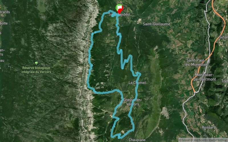


35.7 km
1948 m
1955 m
 Saint-Andéol (38)
 Points of Interest table
| Accum. | Intermediary | |||||||
|---|---|---|---|---|---|---|---|---|
| POI | Description | Alt. | Dist. | D+ | D- | Dist. | D+ | D- |
 Competition organized on 09/16/2017
Trace n°35225
Ascent threshold : 3 m Distance threshold : 30 m Smoothing : Yes Origin of altitudes : MNT Aster GDEM
Ascent threshold : 3 m Distance threshold : 30 m Smoothing : Yes Origin of altitudes : MNT Aster GDEM
Loop
Dominant terrain : Footpath
Max alti. : 1652 m
Avg alti. : 1315 m
Min alti. : 905 m
Longest ascent : 430 m
Longest descent : 570 m
Dominant terrain : Footpath
Max alti. : 1652 m
Avg alti. : 1315 m
Min alti. : 905 m
Longest ascent : 430 m
Longest descent : 570 m
Elevation profile
More tools
Create a new roadbook page
Map and track on your website
Warning ! When you insert a Trace de Trail map on your website, you agree not to hide any element of the module (links to Trail Trail or Trail Connect banner)
Add a realisation
Validate
Add a realisation to share your chrono and describe the conditions that you encountered during you trail running !
Add a comment
Validate
Admin - Trace de Trail
09/06/19, 15:26:18
Bonjour, merci de changer votre date de compétition si vous voulez utiliser cette trace pour l'édition 2019.
09/06/19, 15:26:18
Bonjour, merci de changer votre date de compétition si vous voulez utiliser cette trace pour l'édition 2019.
Show the infos
Add a track


