Show the map
Certified Track - ITRA
Sandstone Way Ultra 2017 - South
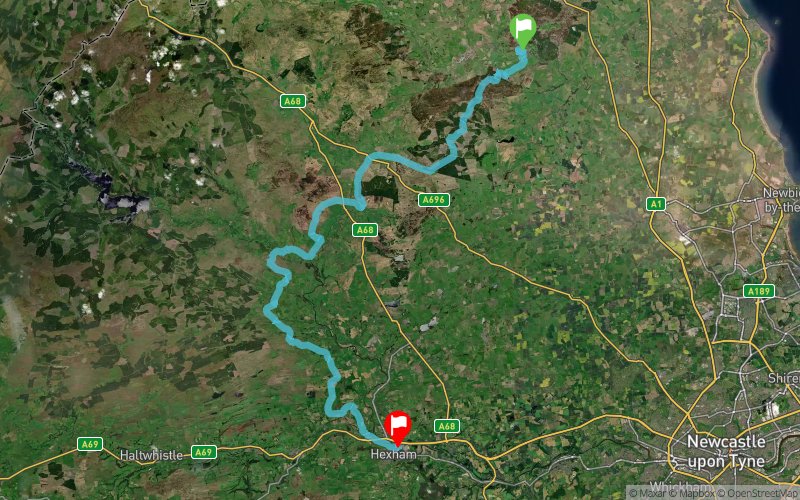


 Rothbury (GB)
 Hexham (GB)

The Sandstone Way South Ultra offers runners an opportunity to run 50 miles on a way marked trail between Rothbury and Hexham. The Sandstone Way South Ultra is the shortest of the three races based on the Sandstone Way. However, runners of the full route claimed that this section between Rothbury and Hexham was the kick in the tail of this challenging run. The initial steep climb out of Rothbury leads to the splendid woodland trails. There are many undulations to complete on this way marked trail which finishes on the banks of the River Tyne in Hexham.
Points of Interest table
| Accum. | Intermediary | |||||||
|---|---|---|---|---|---|---|---|---|
| POI | Description | Alt. | Dist. | D+ | D- | Dist. | D+ | D- |
 Competition organized on 10/07/2017
Trace n°30278
Ascent threshold : 3 m Distance threshold : 0 m Smoothing : No Origin of altitudes : GPS
Ascent threshold : 3 m Distance threshold : 0 m Smoothing : No Origin of altitudes : GPS
Crossing
Dominant terrain : Path
Max alti. : 382 m
Avg alti. : 195 m
Min alti. : 34 m
Longest ascent : 210 m
Longest descent : 240 m
Dominant terrain : Path
Max alti. : 382 m
Avg alti. : 195 m
Min alti. : 34 m
Longest ascent : 210 m
Longest descent : 240 m
Elevation profile
More tools
Create a new roadbook page
Map and track on your website
Warning ! When you insert a Trace de Trail map on your website, you agree not to hide any element of the module (links to Trail Trail or Trail Connect banner)
Add a realisation
Validate
Add a realisation to share your chrono and describe the conditions that you encountered during you trail running !
Add a comment
Validate
Show the infos
Add a track


