Show the map
Certified Track - ITRA
Comano Ursus Extreme Trail 2017 - Stage 1
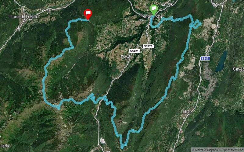


 Ponte Arche (IT)
 Bivedo (IT)


Ultra Trail in two stages. day one is 57km with 4690mD+ and day 2 you will run 58km with 3690D+. The location is the valley between the Garda lake and the Brenta Dolomites range, a wild and untouched land, hard to find nowdays.
Points of Interest table
| Accum. | Intermediary | |||||||
|---|---|---|---|---|---|---|---|---|
| POI | Description | Alt. | Dist. | D+ | D- | Dist. | D+ | D- |
 Competition organized on 07/29/2017
Trace n°29753
Ascent threshold : 10 m Distance threshold : 0 m Smoothing : No Origin of altitudes : GPS
Ascent threshold : 10 m Distance threshold : 0 m Smoothing : No Origin of altitudes : GPS
Crossing
Dominant terrain : Path
Max alti. : 2140 m
Avg alti. : 1317 m
Min alti. : 390 m
Longest ascent : 1530 m
Longest descent : 950 m
Dominant terrain : Path
Max alti. : 2140 m
Avg alti. : 1317 m
Min alti. : 390 m
Longest ascent : 1530 m
Longest descent : 950 m
Elevation profile
More tools
Create a new roadbook page
Map and track on your website
Warning ! When you insert a Trace de Trail map on your website, you agree not to hide any element of the module (links to Trail Trail or Trail Connect banner)
Add a realisation
Validate
Add a realisation to share your chrono and describe the conditions that you encountered during you trail running !
Add a comment
Validate
Show the infos
Add a track


