Show the map
Bois de Mont Derrière - Montagne de Sulens


 Serraval (74)
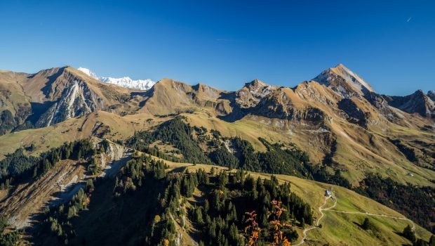
Located between Mont Charvin and Tournette, Montagne de Sulens offers a magnificent panorama on the Aravis Range, as well as the Bauges, Bornes, and Tarentaise Massif. The hike doesn’t have any technical difficulties except the path that is sometimes hard to follow in its upper part just before the Col de Sulens.
Points of Interest table
| Accum. | Intermediary | |||||||
|---|---|---|---|---|---|---|---|---|
| POI | Description | Alt. | Dist. | D+ | D- | Dist. | D+ | D- |
Trace n°29725
Ascent threshold : 5 m Distance threshold : 30 m Smoothing : Yes Origin of altitudes : MNT Aster GDEM
Ascent threshold : 5 m Distance threshold : 30 m Smoothing : Yes Origin of altitudes : MNT Aster GDEM
Loop
Dominant terrain : Path
Max alti. : 1796 m
Avg alti. : 1481 m
Min alti. : 1221 m
Longest ascent : 610 m
Longest descent : 580 m
Route completed by the author : nc
Dominant terrain : Path
Max alti. : 1796 m
Avg alti. : 1481 m
Min alti. : 1221 m
Longest ascent : 610 m
Longest descent : 580 m
Route completed by the author : nc
Elevation profile
More tools
Create a new roadbook page
Map and track on your website
Warning ! When you insert a Trace de Trail map on your website, you agree not to hide any element of the module (links to Trail Trail or Trail Connect banner)
Add a realisation
Validate
Add a realisation to share your chrono and describe the conditions that you encountered during you trail running !
Add a comment
Validate
Show the infos
Add a track


