Show the map
Oxubii
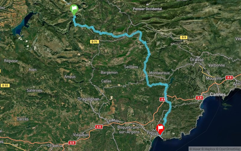


96.7 km
2657 m
3367 m
 Rougon (04)
 Saint-Raphaël (83)
 Points of Interest table
| Accum. | Intermediary | |||||||
|---|---|---|---|---|---|---|---|---|
| POI | Description | Alt. | Dist. | D+ | D- | Dist. | D+ | D- |
Trace n°28656
Ascent threshold : 5 m Distance threshold : 30 m Smoothing : Yes Origin of altitudes : MNT Aster GDEM
Ascent threshold : 5 m Distance threshold : 30 m Smoothing : Yes Origin of altitudes : MNT Aster GDEM
Crossing
Dominant terrain : Path
Max alti. : 1436 m
Avg alti. : 609 m
Min alti. : 3 m
Longest ascent : 530 m
Longest descent : 620 m
Route completed by the author : nc
Dominant terrain : Path
Max alti. : 1436 m
Avg alti. : 609 m
Min alti. : 3 m
Longest ascent : 530 m
Longest descent : 620 m
Route completed by the author : nc
Elevation profile
More tools
Create a new roadbook page
Map and track on your website
Warning ! When you insert a Trace de Trail map on your website, you agree not to hide any element of the module (links to Trail Trail or Trail Connect banner)
Add a realisation
Validate
Add a realisation to share your chrono and describe the conditions that you encountered during you trail running !
Add a comment
Validate
Admin - Trace de Trail
07/11/16, 19:21:47
Bonjour, Merci de renommer votre trace ou de la classer en compétition.
07/11/16, 19:21:47
Bonjour, Merci de renommer votre trace ou de la classer en compétition.
Show the infos
Add a track


