Show the map
Trail Vallée de Joux 2016 - 54 km
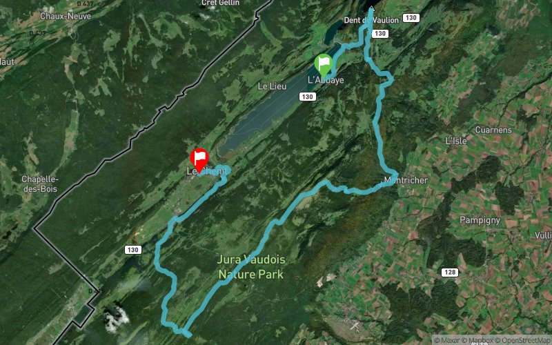


53.9 km
2450 m
2430 m
 L'Abbaye (CH)
 Le Sentier (CH)
 Points of Interest table
| Accum. | Intermediary | |||||||
|---|---|---|---|---|---|---|---|---|
| POI | Description | Alt. | Dist. | D+ | D- | Dist. | D+ | D- |
 Competition organized on 10/09/2016
Trace n°22922
Ascent threshold : 0 m Distance threshold : 30 m Smoothing : Yes Origin of altitudes : MNT Aster GDEM
Ascent threshold : 0 m Distance threshold : 30 m Smoothing : Yes Origin of altitudes : MNT Aster GDEM
Crossing
Dominant terrain : Path
Max alti. : 1659 m
Avg alti. : 1260 m
Min alti. : 767 m
Longest ascent : 910 m
Longest descent : 640 m
Dominant terrain : Path
Max alti. : 1659 m
Avg alti. : 1260 m
Min alti. : 767 m
Longest ascent : 910 m
Longest descent : 640 m
Elevation profile
More tools
Create a new roadbook page
Map and track on your website
Warning ! When you insert a Trace de Trail map on your website, you agree not to hide any element of the module (links to Trail Trail or Trail Connect banner)
Add a realisation
Validate
Add a realisation to share your chrono and describe the conditions that you encountered during you trail running !
Add a comment
Validate
fabiounet80
29/08/16, 21:28:44
Bonsoir, En voulant créer le parcours du trail de la vallée de joux 2016. nous nous sommes rendu compte que vous l'aviez déjà fait. Merci de modifier le titre de votre trace car le parcours 2016 ne sera pas identique au parcours 2015. Merci d'avance Fabien Christinet au nom du comité du Trail de la Vallée de Joux.
Show the infos
Add a track


