Show the map
Trail du Petit-Saint-Bernard 2016
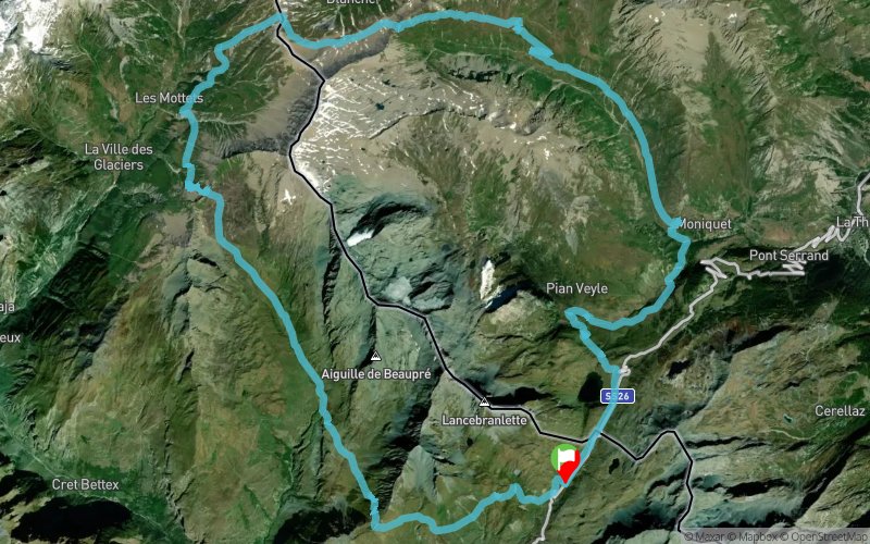


 Séez (73)
 Points of Interest table
| Accum. | Intermediary | |||||||
|---|---|---|---|---|---|---|---|---|
| POI | Description | Alt. | Dist. | D+ | D- | Dist. | D+ | D- |
 Competition organized on 10/02/2016
Trace n°21097
Ascent threshold : 0 m Distance threshold : 30 m Smoothing : Yes Origin of altitudes : MNT Aster GDEM
Ascent threshold : 0 m Distance threshold : 30 m Smoothing : Yes Origin of altitudes : MNT Aster GDEM
Loop
Dominant terrain : Footpath
Max alti. : 2613 m
Avg alti. : 2212 m
Min alti. : 1770 m
Longest ascent : 870 m
Longest descent : 560 m
Dominant terrain : Footpath
Max alti. : 2613 m
Avg alti. : 2212 m
Min alti. : 1770 m
Longest ascent : 870 m
Longest descent : 560 m
Elevation profile
More tools
Create a new roadbook page
Map and track on your website
Warning ! When you insert a Trace de Trail map on your website, you agree not to hide any element of the module (links to Trail Trail or Trail Connect banner)
Add a realisation
Validate
Add a realisation to share your chrono and describe the conditions that you encountered during you trail running !
Add a comment
Validate
GregBureau-Montagne-Haute-Tarentaise
30/04/16, 18:46:08
Bonjour, C'est chose faite. Bonne journée. Grégory Henry
30/04/16, 18:46:08
Bonjour, C'est chose faite. Bonne journée. Grégory Henry
Admin - Trace de Trail
30/04/16, 16:29:15
Bonjour, Merci de classer votre parcours en compétition avant de le placer en publique.
30/04/16, 16:29:15
Bonjour, Merci de classer votre parcours en compétition avant de le placer en publique.
Show the infos
Add a track


