Show the map
Pointe de Perret - Pointe de Chalune - Haute Pointe
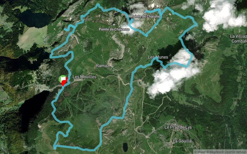


23.9 km
2140 m
2140 m
 Mieussy (74)
 Points of Interest table
| Accum. | Intermediary | |||||||
|---|---|---|---|---|---|---|---|---|
| POI | Description | Alt. | Dist. | D+ | D- | Dist. | D+ | D- |
Trace n°20973
Ascent threshold : 0 m Distance threshold : 30 m Smoothing : Yes Origin of altitudes : MNT Aster GDEM
Ascent threshold : 0 m Distance threshold : 30 m Smoothing : Yes Origin of altitudes : MNT Aster GDEM
Loop
Dominant terrain : Footpath
Max alti. : 2062 m
Avg alti. : 1677 m
Min alti. : 1397 m
Longest ascent : 570 m
Longest descent : 420 m
Route completed by the author : nc
Dominant terrain : Footpath
Max alti. : 2062 m
Avg alti. : 1677 m
Min alti. : 1397 m
Longest ascent : 570 m
Longest descent : 420 m
Route completed by the author : nc
Elevation profile
More tools
Create a new roadbook page
Map and track on your website
Warning ! When you insert a Trace de Trail map on your website, you agree not to hide any element of the module (links to Trail Trail or Trail Connect banner)
Add a realisation
Validate
Add a realisation to share your chrono and describe the conditions that you encountered during you trail running !
Add a comment
Validate
ricou14
12/07/21, 10:34:10
Trace sûrement faite par un bouquetin, impossible pour moi de tirer tout droit sur les crêtes. Trace inintéressante et dangereuse. À ne pas faire!!!
12/07/21, 10:34:10
Trace sûrement faite par un bouquetin, impossible pour moi de tirer tout droit sur les crêtes. Trace inintéressante et dangereuse. À ne pas faire!!!
Show the infos
Add a track


