Show the map
Evaluated Track - ITRA
Lozère Trail 2016 - Ultra Lozere - Stage 2
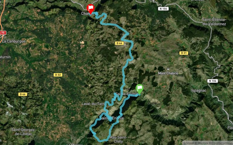


 Sainte-Enimie (48)
 Chanac (48)


Welcome in Lozère...
We welcome you to an authentic place. Here nature has managed to claims its rights and imposes its beauty.
Despite being preserved, Lozere is not remote. Indeed it is located at 10mn from highway A75:
5h from Paris.
Saturday may 14th: 54km and 3200m climbs
The entire route is in the heart of the Gorges du Tarn, consisting of a single track to a montainside, some parts of stimulus on the Causse de Sauveterre or Causse Mejean. 53km quite technical in a calcareous environment.
Sunday may 15th: 54km and 2300m climbs
tracks less technical than the first stage. You will for 30km in the Gorges du Tarn, then a quick crossing of the Causse de Sauveterre (about 12km). A final completely changed from 2014, with beautiful single track and direct descent to the finish line in Chanac.
a class territory to UNESCO World Heritage
Points of Interest table
| Accum. | Intermediary | |||||||
|---|---|---|---|---|---|---|---|---|
| POI | Description | Alt. | Dist. | D+ | D- | Dist. | D+ | D- |
 Competition organized on 05/14/2016
Trace n°19349
Ascent threshold : 0 m Distance threshold : 30 m Smoothing : Yes Origin of altitudes : MNT IGN
Ascent threshold : 0 m Distance threshold : 30 m Smoothing : Yes Origin of altitudes : MNT IGN
Crossing
Dominant terrain : Footpath
Max alti. : 1014 m
Avg alti. : 776 m
Min alti. : 451 m
Longest ascent : 500 m
Longest descent : 470 m
Dominant terrain : Footpath
Max alti. : 1014 m
Avg alti. : 776 m
Min alti. : 451 m
Longest ascent : 500 m
Longest descent : 470 m
Elevation profile
More tools
Create a new roadbook page
Map and track on your website
Warning ! When you insert a Trace de Trail map on your website, you agree not to hide any element of the module (links to Trail Trail or Trail Connect banner)
Add a realisation
Validate
Add a realisation to share your chrono and describe the conditions that you encountered during you trail running !
Add a comment
Validate
Show the infos
Add a track


