Show the map
Trail des Gets 2023 2023 - Trail des Gets 2024 - Trail vert
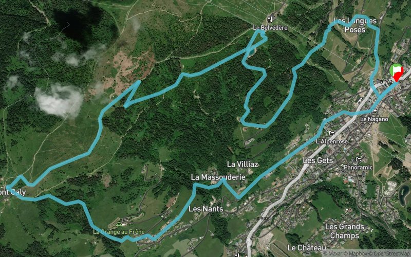


 Les Gets (74)
If you are new to running in the mountains, this discovery trail is for you!
About ten kilometres, between forests and mountain pastures, to admire the view of Mont Blanc from Mont Caly. With gradual climbs and rolling terrain, the course offers the option to discover the trails of Les Gets without too much difficulty.
This loop starts in the centre of the village and takes you through several small hamlets with pretty chalets to Mont Caly, where a superb view of the Mont Blanc range awaits. After a small refreshment, you progress between the undergrowth and the balconies of Mont Chéry before a descent into the forest to reach the village.
Points of Interest table
| Accum. | Intermediary | |||||||
|---|---|---|---|---|---|---|---|---|
| POI | Description | Alt. | Dist. | D+ | D- | Dist. | D+ | D- |
 Competition organized on 07/23/2023
Trace n°184741
Ascent threshold : 0 m Distance threshold : 30 m Smoothing : Yes Origin of altitudes : MNT Aster GDEM
Ascent threshold : 0 m Distance threshold : 30 m Smoothing : Yes Origin of altitudes : MNT Aster GDEM
Loop
Dominant terrain : Path
Max alti. : 1587 m
Avg alti. : 1362 m
Min alti. : 1161 m
Longest ascent : 500 m
Longest descent : 320 m
Dominant terrain : Path
Max alti. : 1587 m
Avg alti. : 1362 m
Min alti. : 1161 m
Longest ascent : 500 m
Longest descent : 320 m
Elevation profile
More tools
Create a new roadbook page
Map and track on your website
Warning ! When you insert a Trace de Trail map on your website, you agree not to hide any element of the module (links to Trail Trail or Trail Connect banner)
Add a realisation
Validate
Add a realisation to share your chrono and describe the conditions that you encountered during you trail running !
Add a comment
Validate
Show the infos
Add a track


