Show the map
Duathlon de Guereins 2020 - VTT
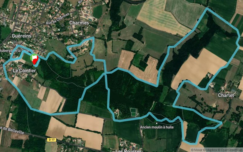


9.6 km
170 m
170 m
 Guéreins (01)
 Points of Interest table
| Accum. | Intermediary | |||||||
|---|---|---|---|---|---|---|---|---|
| POI | Description | Alt. | Dist. | D+ | D- | Dist. | D+ | D- |
 Competition organized on 05/03/2020
Trace n°107396
Ascent threshold : 3 m Distance threshold : 30 m Smoothing : Yes Origin of altitudes : MNT Aster GDEM
Ascent threshold : 3 m Distance threshold : 30 m Smoothing : Yes Origin of altitudes : MNT Aster GDEM
Loop
Dominant terrain : Footpath
Max alti. : 235 m
Avg alti. : 196 m
Min alti. : 169 m
Longest ascent : 70 m
Longest descent : 60 m
Dominant terrain : Footpath
Max alti. : 235 m
Avg alti. : 196 m
Min alti. : 169 m
Longest ascent : 70 m
Longest descent : 60 m
Elevation profile
More tools
Create a new roadbook page
Map and track on your website
Warning ! When you insert a Trace de Trail map on your website, you agree not to hide any element of the module (links to Trail Trail or Trail Connect banner)
Add a realisation
Validate
Add a realisation to share your chrono and describe the conditions that you encountered during you trail running !
Add a comment
Validate
dodoh01
21/06/20, 20:00:33
attention a 5km, la descente dans le ruisseau. entre 7.9 et 8.2km, le parcours n'existe pas en temps normal. on traverse un peuplière qui est un champ de ronce et d'ortie en juin.
21/06/20, 20:00:33
attention a 5km, la descente dans le ruisseau. entre 7.9 et 8.2km, le parcours n'existe pas en temps normal. on traverse un peuplière qui est un champ de ronce et d'ortie en juin.
Show the infos
Add a track


