Show the map
Boréon - Col Guilié - Ref. Remondino
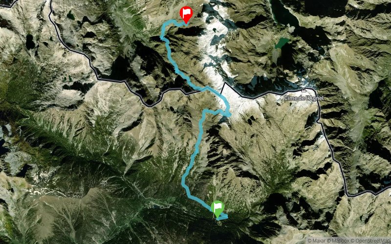


11.8 km
1633 m
792 m
 Saint-Martin-Vésubie (06)
 Sant'Anna Di Valdieri (IT)
 Points of Interest table
| Accum. | Intermediary | |||||||
|---|---|---|---|---|---|---|---|---|
| POI | Description | Alt. | Dist. | D+ | D- | Dist. | D+ | D- |
Trace n°10460
Ascent threshold : 3 m Distance threshold : 30 m Smoothing : Yes Origin of altitudes : MNT Aster GDEM
Ascent threshold : 3 m Distance threshold : 30 m Smoothing : Yes Origin of altitudes : MNT Aster GDEM
Crossing
Dominant terrain : Footpath
Max alti. : 2818 m
Avg alti. : 2224 m
Min alti. : 1609 m
Longest ascent : 1236 m
Longest descent : 769 m
Route completed by the author : nc
Dominant terrain : Footpath
Max alti. : 2818 m
Avg alti. : 2224 m
Min alti. : 1609 m
Longest ascent : 1236 m
Longest descent : 769 m
Route completed by the author : nc
Elevation profile
More tools
Create a new roadbook page
Map and track on your website
Warning ! When you insert a Trace de Trail map on your website, you agree not to hide any element of the module (links to Trail Trail or Trail Connect banner)
Add a realisation
Validate
Add a realisation to share your chrono and describe the conditions that you encountered during you trail running !
Add a comment
Validate
gionata80
12/08/15, 00:26:15
Boucle sur 3 1/2 jour: Parking Boréon - Ref. Remondino - Ref. Pagari - Relais des Merveilles - Boréon. Première étape. Demi journée du Parking au Refuge Remondino.
12/08/15, 00:26:15
Boucle sur 3 1/2 jour: Parking Boréon - Ref. Remondino - Ref. Pagari - Relais des Merveilles - Boréon. Première étape. Demi journée du Parking au Refuge Remondino.
Show the infos
Add a track


