Show the map
Certified Track - ITRA
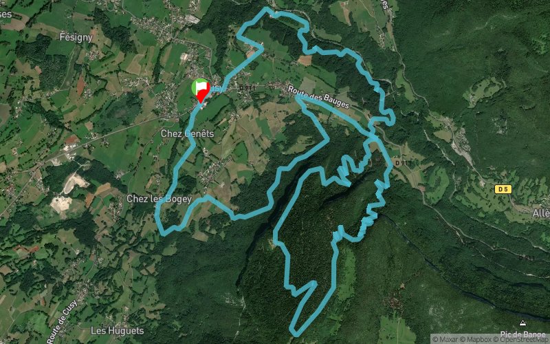
Cusy'Hard 2020 - 23 km


22.8 km
1520 m
1510 m


Points of Interest table
Accum. | Intermediary | |||||||
---|---|---|---|---|---|---|---|---|
POI | Description | Alt. | Dist. | D+ | D- | Dist. | D+ | D- |

Trace n°97417
Ascent threshold : 3 m Distance threshold : 0 m Smoothing : No Origin of altitudes : GPS
Loop
Dominant terrain : Path
Max alti. : 1375 m
Avg alti. : 810 m
Min alti. : 443 m
Longest ascent : 970 m
Longest descent : 860 m
Dominant terrain : Path
Max alti. : 1375 m
Avg alti. : 810 m
Min alti. : 443 m
Longest ascent : 970 m
Longest descent : 860 m
Elevation profile

Their last tracks
More tools
Create a new roadbook page
Carte à la Carte IGN
Map and track on your website
Warning ! When you insert a Trace de Trail map on your website, you agree not to hide any element of the module (links to Trail Trail or Trail Connect banner)
Add a realisation
Validate
Add a realisation to share your chrono and describe the conditions that you encountered during you trail running !
Add a comment
Validate

Admin
15/09/19, 22:10:36
Bonjour, Merci de classer votre trace en compétition et de la renommer avant de la placer en public.
15/09/19, 22:10:36
Bonjour, Merci de classer votre trace en compétition et de la renommer avant de la placer en public.
Nearby tracks
3.0 km St Off en Trail 2019 - La Speed Trail des Coteaux - STC 10 km
10.1 km
450 m
540 m
Saint-Offenge (73)
3.2 km Pont de l'Abîme - Col de la Cochette - Golet du Taisson - Le Revard
35.2 km
2070 m
1970 m
Cusy (74)
3.4 km Lachat - Creux de Lachat - Col de la Cochette - Chalet du Trousset
26 km
1530 m
1510 m
Saint-Ours (73)
3.5 km Lachat - St-Offenge - Creux de Lachat - Les Trois Bornes - Cusy
23.6 km
1170 m
1160 m
Saint-Ours (73)
Show the infos
Add a track