Show the map
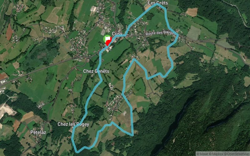
Cusy'Hard 2018 - 7 km
Points of Interest table
Accum. | Intermediary | |||||||
---|---|---|---|---|---|---|---|---|
POI | Description | Alt. | Dist. | D+ | D- | Dist. | D+ | D- |
Competition organized on 06/10/2018
Trace n°50177
Ascent threshold : 3 m Distance threshold : 30 m Smoothing : Yes Origin of altitudes : MNT Aster GDEM
Loop
Dominant terrain : Path
Max alti. : 722 m
Avg alti. : 616 m
Min alti. : 535 m
Longest ascent : 120 m
Longest descent : 170 m
Dominant terrain : Path
Max alti. : 722 m
Avg alti. : 616 m
Min alti. : 535 m
Longest ascent : 120 m
Longest descent : 170 m
Elevation profile
More tools
Create a new roadbook page
Map and track on your website
Warning ! When you insert a Trace de Trail map on your website, you agree not to hide any element of the module (links to Trail Trail or Trail Connect banner)
Add a realisation
Validate
Add a realisation to share your chrono and describe the conditions that you encountered during you trail running !
Add a comment
Validate
Admin - Trace de Trail
06/01/18, 17:34:31
Bonjour, Merci de renommer votre trace et de la classer en compétition avant de la placer en publique.
06/01/18, 17:34:31
Bonjour, Merci de renommer votre trace et de la classer en compétition avant de la placer en publique.
Show the infos
Add a track