
Krabat Trail 2023 2023-Krabat Trail 18K
ITRA
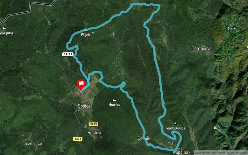
 18.2 km
870 m
870 m
18.2 km
870 m
870 m

18/03/2023
GPX
90
PDF
Profile
Share
3D
Favorites
Reviews
Like
SoA¡ice (HR) SoA¡ice (HR)
Effort kilometer
Longest ascent
Longest descent
26
800 m
410 m
Max. elevation
Min. elevation
Quality index
971 m
241 m
 1pt/17m
Start
Distance
0 km
Altitude
563 m
D+
0 m
D-
0 m
18.2 km
866 m
865 m
Finish
Distance
18.2 km
Altitude
562 m
D+
866 m
D-
865 m
Click on a point of interest to display it on the map
Reviews and times
Add a track
Krabat Trail 2023 2023-Krabat Trail 18K

Track number : 201341
Link to track :
https://tracedetrail.fr/en/trace/201341
Log in to insert this track on your website
 Trace de Trail