
 4.46 km
1081 m
0 m

 1pt/8m
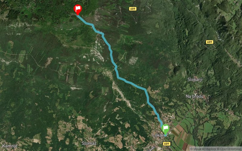
Čaven Vertikal – 4,3 km, 1081 m V+ · štart ob 11:00 · Lokavec → Koča Antona Bavčerja
Vertikalni kilometer. Palice so dovoljene. Časovni limit je 2 uri in 13 minut. Cilj pri Koči Antona Bavčerja se zapre ob 13.13. Hrana in pijača bosta na voljo tudi na cilju (Koča Antona Bavčerja).
Čaven Vertikal šteje za pokal Primorskih gorskih tekov PGT - Vertikal
Kombi prevoz bo na voljo med Lokavcem in Kočo Antona Bavčerja. Na voljo bodo štiri vožnje od koče do Lokavca – dve pred štartom in dve po zaključku Vertikala.
Obvezno na obeh trasah: Mobilni telefon (napolnjen, vključen ves čas tekme) · Osebna skodelica/steklenica
www.caven.run
Čaven Vertikal · 4.3 km · 1,081 m D+
Saturday 21 November 2026 · start 11:00 am in Lokavec
A vertical kilometre from Lokavec up to Koča Antona Bavčerja.
Water at Potok (km 2.4); food and drink at the finish.
Poles are allowed. Time limit: 2 hours 13 minutes (the finish at Koča Antona Bavčerja closes at 1:13 pm).
The Čaven Vertikal counts towards the Vertikal cup of the Primorski gorski teki (PGT) series.
Mandatory kit: a mobile phone, charged and switched on for the whole race, and your own cup or bottle.
A minibus shuttle runs down from Koča Antona Bavčerja to Lokavec four times: at 9:10 and 10:00 am, before the start, and at 12:30 and 1:30 pm, after the Vertikal.
Full details: www.caven.run


 Trace de Trail