
NPT
ITRA
 57.11 km
2731 m
2731 m
57.11 km
2731 m
2731 m


Like
Favorites
Reviews
Share
GPX
8
PDF A4
PDF A0
Profile
Flyover
3D
Insert
Passages
Weang Hang (TH) Weang Hang (TH)
Effort kilometer
Longest ascent
Longest descent
84
820 m
830 m
Max. elevation
Min. elevation
Quality index
1354 m
391 m
 1pt/13m
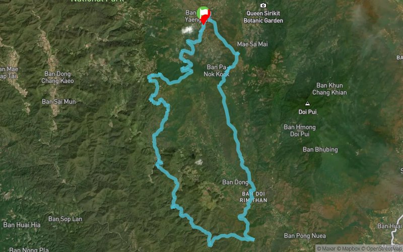
The River Loop, the Nin Prapa Trail (NPT), as the name suggests, will follow the course of streams and rivers to the very bottom and Southernmost of the route before climbing back up slowly to where you started.
Most runners need to pay more attention to the time it takes to complete the loop, so be prepared that it might take you longer than anticipated!
En voir plus... En voir moins...

Start
Distance
0 km
Altitude
781 m
D+
0 m
D-
0 m
57.1 km
2731 m
2731 m
Finish
Distance
57.1 km
Altitude
781 m
D+
2731 m
D-
2731 m
Click on a point of interest to display it on the map
Reviews and times
Add a track
Pong Yaeng Trail NPT

Track number : 263802
Link to track :
https://tracedetrail.fr/en/trace/263802
Log in to insert this track on your website
 Trace de Trail