
In this section, you'll find all the features you need to prepare the maps and cartographic material you'll need for your event, as well as administrative material :
1. Create maps and insert them on your website
On Trace de Trail, you can create personalized maps, including routes, zones and points of interest. These maps can be used for a variety of purposes:
- Get a global view of your routes
- Combine several routes on the same map: stages of a race over several days, event routes + emergency access zones, etc..
- Create a map to manage your event with the of start and finish areas, parking, number collection, etc.
- Associate zones with one or several routes : safety zones, race neutralisation, environmental protection zones, etc..
The options for designing are as numerous as your potential needs!
Create your personalized map
We explain it here how to prepare your personalized map
Insert the map on your website
Premium pro subscribers only
If you are a Premium pro subscriber, you can insert the map on your website as an Iframe.. We explain here how to do it !
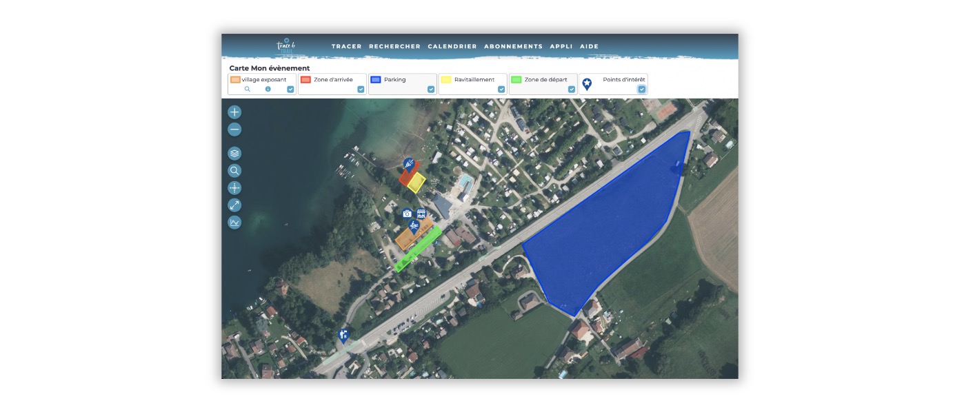
On Trace de Trail, you have all the tools you need to create your race HQ maps.
With a Discover pro or Premium pro subscription , you have a large number of points of interest special for organizers to document your route: refreshment points, security, signalmen, etc.
Discover all points of interest available here
You can also add alternative routes (fallback routes, rerouting, emergency access, etc.).
Discover how to create alternative routes and sections here
How to create your race HQ map ?
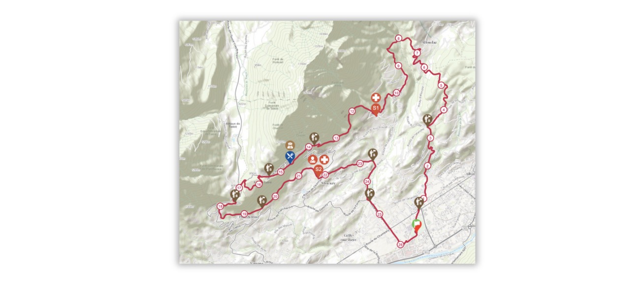
In France, declaration-manifestations.gouv.fr is the platform you need to use to register your event. The platform includes a cartographic section, on which you can add your routes and the positioning of your various points of interest (refreshment points, first-aid posts, marshals, etc.). On Trace de Trail, you can upload your trail + points of interest in GPX format directly compatible with the platform.
How to download a GPX compatible declaration-manifestations ?
- Shape your route with points of interest
- On the route page, click on GPX
- Select GPX format compatible Declaration-manifestations and choose between using POI catégories or using the POI map display. Download GPX.

Which POIs are compatible ?
All POIs with a star

How to choose between "POI category" and "POI map display" ?
The choice depends on how you entered your POIs :
- If you have selected categories in the “Content” section -> use POI categories
- If you have only used the symbols or labels on the card -> use the POI map display

Examples of exports from Trace de Trail to the platform using both methods :


 Trace de Trail