
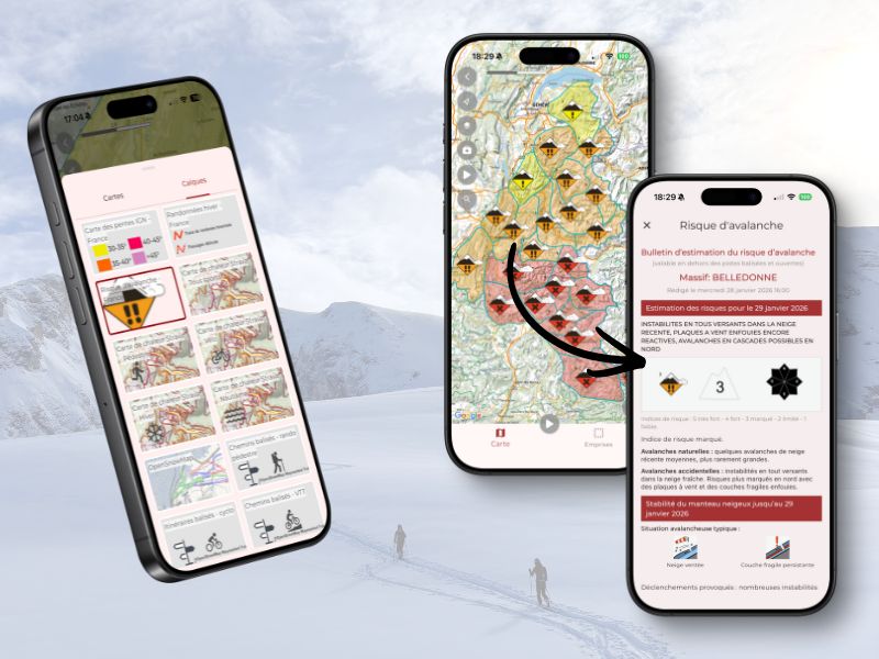
You can now consult the Avalanche Risk Assessment Bulletins (BERA) from Météo-France directly in Trail Connect, updated daily.
The BERA are available by mountain range across France, in the Alps, the Pyrenees, and Corsica.
To view the Bulletins, go to a route page or to the Map section, open the list of available map backgrounds and select “Overlays”, then “Risques d'Avalanche – France.”
Then, on the map, tap a colored area on the map to display the latest available bulletin for the massif. The bulletin layout is optimized for smartphone screens, and it can also be viewed in PDF format.
Please note :
For your winter outings, you can also display the slope angle map as well as IGN winter hiking routes directly in the app.
Both layers are available in the “Layers” tab and can be overlaid on your usual map background.


 Trace de Trail