
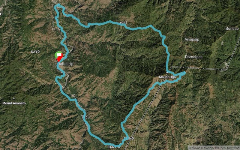
Cordillera Mountain Ultra 2018 - 50K
 47 km
2590 m
2590 m
47 km
2590 m
2590 m
04/03/2018
GPX
16
PDF
Profil
Partager
3D
Favoris
Avis
J'aime
Itogon (PH) (PH)
Kilomètre effort
Plus longue montée
Plus longue descente
72
1310 m
1710 m
Altitude max
Altitude min
Indice de qualité
2166 m
362 m
 1pt/5m
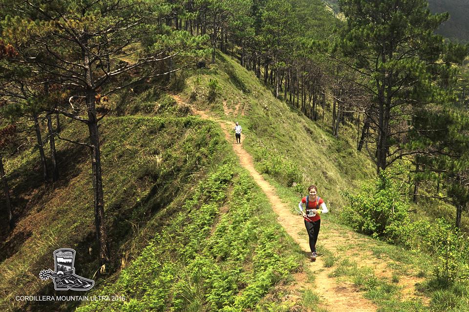
The 50km Cordillera Mountain Ultra will traverse around Mt. Ugo in Benguet. Topping out at 2150m it features long ridge lines covered in Pine forests as well as superb views of the West Philippine sea, the entire Agno River Valley as well as the Cagayan Valley of Nueva Vizcaya.
The race starts with a run through the Agno River valley to the small village of Tabu, from here it is a steep vertical km up to the village of Bantik where superb views of the Agno River and the West Philippine Sea can be had. From the top of the ridge it is a 5 km downhill run to the village of Uling and then a long 15km Pine forest ridge that will lead you to the top of Mt. Ugo. From the summit of Mt. Ugo you will descend 15kms through the village of Lusod to the village of Tinungdan cross a few hanging bridges and then run through the rice fields by the banks of the Agno river for the last 10kms to the finish line in Dalupirip.
En voir plus... En voir moins...

Départ
Distance
0 km
Altitude
415 m
D+
0 m
D-
0 m
47 km
2590 m
2590 m
Arrivée
Distance
47 km
Altitude
415 m
D+
2590 m
D-
2590 m
Cliquez sur un point d'intérêt pour l'afficher sur la carte
Avis et chronos
Ajouter une trace
Cordillera Mountain Ultra 2018 - 50K

Numéro de trace : 45190
Lien vers la trace :
https://tracedetrail.fr/fr/trace/45190
Connectez-vous pour insérer cette trace sur votre site web
 Trace de Trail