
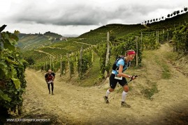
Trail del Moscato 2019 - Paesi Tuoi
ITRA
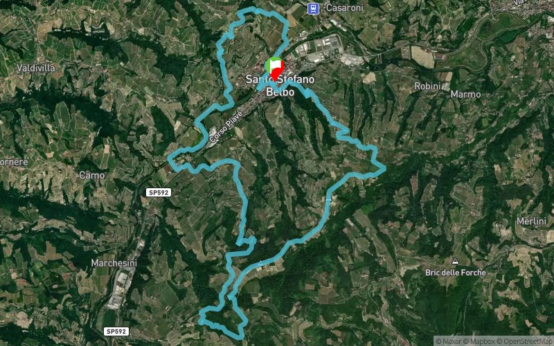
 20.7 km
1130 m
1160 m
20.7 km
1130 m
1160 m

J'aime
Favoris
Avis
Partager
GPX
1
PDF A4
PDF A0
Profil
Flyover
3D
Insérer
Passages
Santo Stefano Belbo (IT) Santo Stefano Belbo (IT)
Kilomètre effort
Plus longue montée
Plus longue descente
32
390 m
290 m
Altitude max
Altitude min
Indice de qualité
631 m
152 m
 1pt/17m
September 29 - International sports event RUNNING OUTDOOR through the magnificent hills of LANGHE - ITALY - UNESCO WORLD HERITAGE SITE thanks to the exceptional value of the culture of wine Moscato, Barolo and Barbaresco, which over the centuries has shaped the land. Wine, Truffles and fabulous scenery are waiting athletes and walkers from all over the world to match the outdoor sports to the discovery of the territory, landscapes and culture of gourmet food and wine . It is a running race of Trail Running entirely on dirt road through the hills of Moscato, Pavese’s paths, vineyards and woods in the municipalities of S. Stefano Belbo and Castiglione Tinella – ITALY - 3 competitive RACES – 54 Km “Lavorare Stanca” - 3070 mt positive altitude / start at 07.30 am - 96% off road - 21 Km “ Paesi Tuoi” - 1100 mt positive altitude / start at 09.30 am - 96% off road - 10 Km “Sali Scendi” - 650 mt positive altitude / start at 10.00 am- offroad e asphalt The event also provides other three proposals: - NORDIC WALKING - (10 km -21 km) – start at 10.15 - WALK WINE TOURISM - start at 10.30 through hills and farmhouses in order to taste wine, truffles and local products. - KIDS FUN RUN - Race 2 km for children till 13 years THE “TRAIL del MOSCATO” of 54 KM is on the list of Qualifying races for entry to “Ultra-Trail du Mont-Blanc®” 2020 and La Sportiva Lavaredo Ultra-Trail and Trail Verbier Saint Bernard - X-Alpine.. Is a race of Grand Prix IUTA Ultratrail 2019. web: http://www.dynamic-center.it/events-english/trail-del-moscato-2019/
En voir plus... En voir moins...
Trace créée par dynamic
le 04/02/2019 (modifiée le 11/02/2019)
le 04/02/2019 (modifiée le 11/02/2019)

Départ
Distance
0 km
Altitude
178 m
D+
0 m
D-
0 m
20.7 km
1130 m
1160 m
Arrivée
Distance
20.7 km
Altitude
178 m
D+
1130 m
D-
1160 m
Cliquez sur un point d'intérêt pour l'afficher sur la carte
Avis et chronos
Ajouter une trace
Trail del Moscato 2019 - Paesi Tuoi

Numéro de trace : 78891
Lien vers la trace :
https://tracedetrail.fr/fr/trace/78891
Connectez-vous pour insérer cette trace sur votre site web
 Trace de Trail