
La Corsa della Bora 2018 - S1 Trail 57 km
ITRA
 55.2 km
2310 m
2650 m
55.2 km
2310 m
2650 m


J'aime
Favoris
Avis
Partager
GPX
77
PDF A4
PDF A0
Profil
Flyover
3D
Insérer
Passages
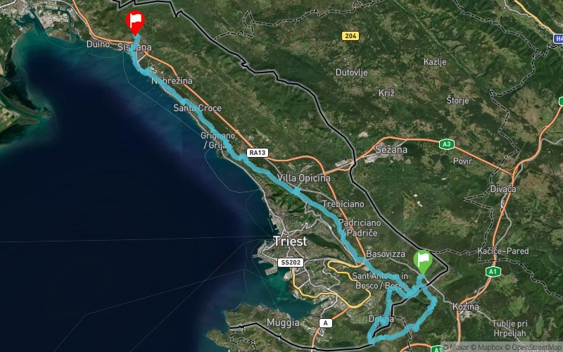
Sant'Antonio In Bosco (IT) Sistiana (IT)
Kilomètre effort
Plus longue montée
Plus longue descente
78
340 m
340 m
Altitude max
Altitude min
Indice de qualité
459 m
48 m
 1pt/13m
57 km overlooking the Gulf of Trieste with high mountain views less than 400 meters above sea level. Unique landscapes, excellent food and fun on a journey that is the best way to start a great 2018.
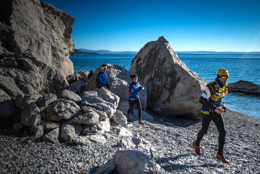
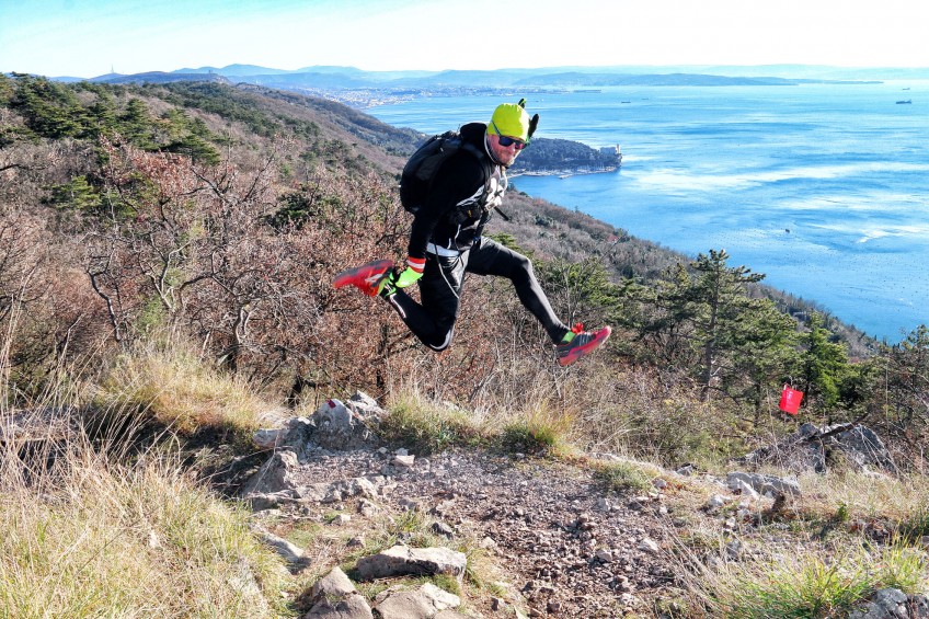
Here, don’t expect to find two similar sections. There are extremely fast trails, were you will reach your maximum speed, and paths where is not always possible to run. The section in the Rosandra valley will take you trough a Dolomitic-like scenario, with steep grounds that usually are found in high mountains. Here, you will find those characteristics only at an altitude of 400 meters.
The steep and rocky ground, the red soil, the limestone gravels, will run with you near to small “foibe” (deep cracks in the terrain). The unique geological conformation of this land will offer you a wide variety of panoramas, creating a race that constantly chances its looks. Here, every sight is unique.
Starting a downhill towards Slovenia, crossing the ancient Austrian railway and heading towards the Karst plateau swept by the winds of Bora. Here, it will get a view of the Gulf of Trieste and Koper, before tackling the difficult passages of the Val Rosandra, leading, after a steep climb, a race with “sea view”.
En voir plus... En voir moins...
Trace créée par sentierouno
le 30/09/2017 (modifiée le 03/10/2017)
le 30/09/2017 (modifiée le 03/10/2017)

Pesek
Distance
0 km
Altitude
459 m
D+
0 m
D-
0 m
55.2 km
2305 m
2645 m
Sistiana
Distance
55.2 km
Altitude
119 m
D+
2305 m
D-
2645 m
Cliquez sur un point d'intérêt pour l'afficher sur la carte
Avis et chronos
Ajouter une trace
La Corsa della Bora 2018 - S1 Trail 57 km

Numéro de trace : 44945
Lien vers la trace :
https://tracedetrail.fr/fr/trace/44945
Connectez-vous pour insérer cette trace sur votre site web
 Trace de Trail