
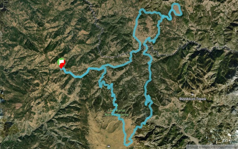
 48.83 km
1316 m
1316 m
48.83 km
1316 m
1316 m
 1pt/20m
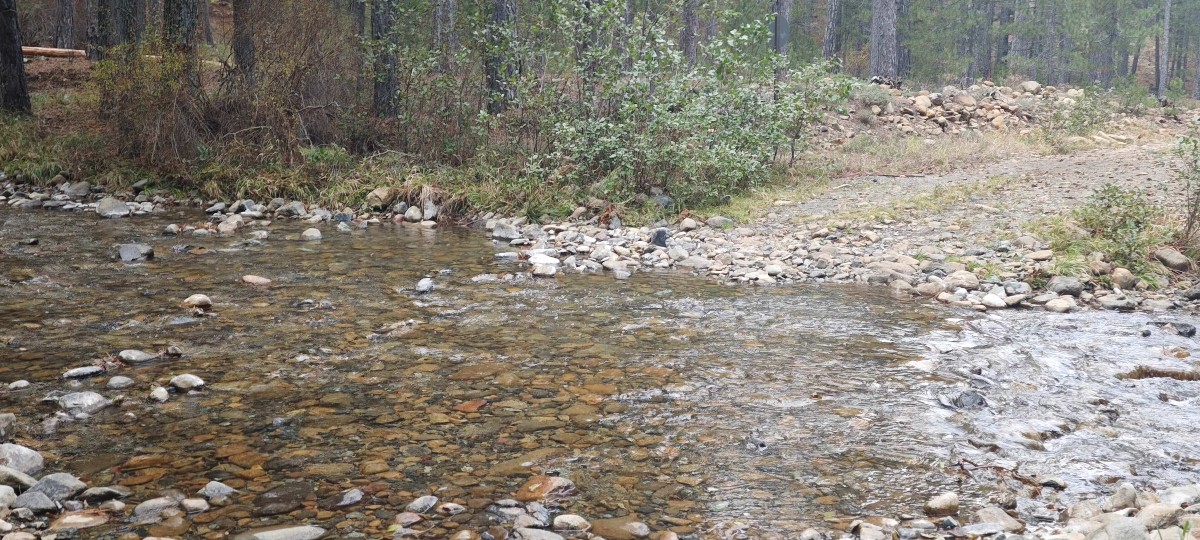
Kartalgolu Ultra Trail 50K unfolds around the pristine heart of the Sandras Mountain range, in the highlands of Denizli – Beyagac, southwestern Turkey. The course begins near the legendary Kartal Lake Nature Reserve, home to ancient cedar forests, crystal springs, and wildlife that thrives in one of Anatolia’s most untouched ecosystems. The 50K route combines challenging climbs, fast technical descents, and runnable forest sections through pine and cedar woodlands. Runners ascend to panoramic ridgelines above 2,000 meters, where the view opens toward the Taurus range and the high valleys of Sandras. With a total distance of 50 kilometers and an elevation gain of approximately 2,100 meters, the race offers a demanding yet deeply rewarding mountain experience. This course is designed for experienced trail runners who seek balance — enough challenge to test endurance and skill, yet fluid enough to allow rhythm and flow in the wild heart of nature. Every turn of the trail carries traces of the Yörük nomads who once roamed these mountains, reminding each runner of the ancient harmony between human and land. The Kartalgolu Ultra Trail 50K is not just a competition — it is an encounter with silence, wind, and the living memory of the mountains. The event is organized with respect for nature, sustainability, and the preservation of local heritage. Every participant is invited to run lightly on the earth, honoring both the trail and the spirit of Sandras.


 Trace de Trail