
 16.79 km
1355 m
1355 m

 1pt/7m
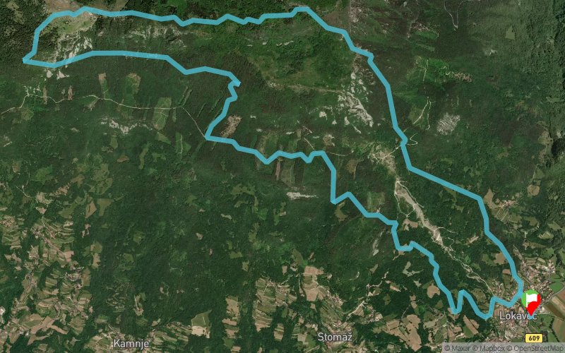
Čaven Trail – 17 km, 1355 m V+ · štart ob 09:30 · Lokavec → Koča Antona Bavčerja → Kucelj → Lokavec
Vzpon se začne na travnikih nad Lokavcem, od koder nas strma pot vodi skozi gozd proti obronkom Čavna. Ko se gozd razpre, nas pričaka čudovit razgled na kraško pokrajino, Tržaški zaliv in domačo Vipavsko dolino. Tukaj se Vertikal konča, Trail pa pot nadaljuje in zaokroži do Kuclja, s ciljem v Lokavcu.
Krožna proga: Lokavec, koča Antona Bavčerja na Čavnu, Kucelj in nazaj v Lokavec. Palice so dovoljene. Časovni limit je šest ur, cilj se zapre ob 15.30.
Obvezno na obeh trasah: Mobilni telefon (napolnjen, vključen ves čas tekme) · Osebna skodelica/steklenica
www.caven.run
Čaven Trail · 17 km · 1,355 m D+
Saturday 21 November 2026 · start 9:30 am in Lokavec
The climb starts in the meadows above Lokavec, and from there a steep path leads up through the forest towards the slopes of Čaven. When the trees open up, the view takes in the Karst, the Gulf of Trieste and the Vipava Valley. This is where the Čaven Vertikal finishes, at Koča Antona Bavčerja; the Trail carries on to Kucelj and loops back to the finish in Lokavec.
Loop course: Lokavec, Koča Antona Bavčerja on Čaven, Kucelj and back to Lokavec.
Aid stations: water at Potok (km 2.4), food and drink at Koča Antona Bavčerja (km 4.5), water at Kucelj (km 7.5).
Poles are allowed. Time limit: 6 hours (the finish closes at 3:30 pm).
Mandatory kit: a mobile phone, charged and switched on for the whole race, and your own cup or bottle.
Full details: www.caven.run


 Trace de Trail