
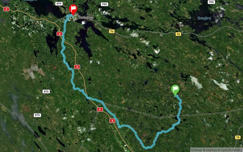
Vuokatti Trail Challenge 2017 - 100 km
ITRA
 101.3 km
2410 m
2440 m
101.3 km
2410 m
2440 m

J'aime
Favoris
Avis
Partager
GPX
30
PDF A4
PDF A0
Profil
Flyover
3D
Insérer
Passages
Inconnu (ND) Pohjavaara (FI)
Kilomètre effort
Plus longue montée
Plus longue descente
125
160 m
180 m
Altitude max
Altitude min
Indice de qualité
372 m
127 m
 1pt/17m
100km
0-10 km
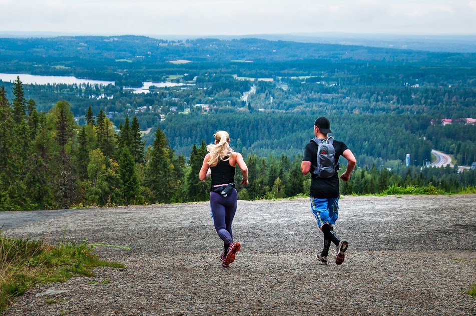
100 km competition starts from Hiidenportti National Park which is located in the region of Kainuu, Finland and municipality of Sotkamo. Wilderness sceneries in the start area are totally amazing. First 10 km of the track will lead the runners through the Hiidenportti National Park. The foothpath is quite narrow all the way but the sceneries are fantastic when the path will guide the runners through the Hiidenportti canyon area and after that very old forest area. First 10 km are quite easy to run with only few little hills. In this section the route is quite flat.
VTC2016_Esittely_1 VTC2016_Esittely_3
Photos from the Hiidenportti National Park
10-20 km
In this section runners will follow Talonpojan Taival –hiking trail but the path is very small and there is plenty of ground vegetation. Terrain is mainly commercial forest with recently planted trees and logging places and is therefore quite slow and heavy to run expesially on the few swamp areas. In the end of this section the bigger hills comes to the picture when runners are approaching the Murtovaara service station. Murtovaara house museum area is few hundred years old where runners will still feel the history of the old buildings and surroundings.
20-30km
After Murtovaara service station the route will continue to follow Talonpojan Taival –hiking trail to Peurajärvi area and after that Kiuruvaara hill area and Halmejärvi service station. In this section the path is very small and there is plenty of ground vegetation. Terrain is mainly commercial forest with recently planted trees and logging places and is therefore quite slow and heavy to run. Yet, the sceneries are good in this area and you can feel the wilderness around you. Also in this section the bigger hills comes to the picture in the end when runners are approaching the Kiuruvaara Hill area. From Kiuruvaara, runners will come down 100 meters of elevation to Halmejärvi service station.
VTC2016_Esittely_5
Photo from Peurajärvi
30-100km
After the Halmejärvi service point the route carries on towards Maanselän Etappi via UKK-hiking track. In this part of the track the runner can admire e.g. Tavikoski rapid and magnificent several kilometers long esker on top of where the track runs. Sometimes spectacular viewpoints on top of ridges and forest hills surprise runners. Especially this part of the Vuokatti Trail Challenge radiates the spirit of wilderness and silence of forests where runner can enjoy clean and green nature. From Maanselän Etappi the route continues via 42 km route (see 42 km route description) towards the legendary 13 Hill´s area called Vuokatinvaara which is the great and extremely hard ending to 100 km track. Sceneries are amazing in this Vuokatinvaara area which will start about 23km before finish.
En voir plus... En voir moins...

Municipality of Valtimo, Hiidenportti Natinal Park
Distance
0 km
Altitude
199 m
D+
0 m
D-
0 m
101.3 km
2403 m
2433 m
Municipality of Sotkamo, Vuokatti Sport Institute
Distance
101.3 km
Altitude
170 m
D+
2403 m
D-
2433 m
Cliquez sur un point d'intérêt pour l'afficher sur la carte
Avis et chronos
Ajouter une trace
Vuokatti Trail Challenge 2017 - 100 km

Numéro de trace : 29234
Lien vers la trace :
https://tracedetrail.fr/fr/trace/29234
Connectez-vous pour insérer cette trace sur votre site web
 Trace de Trail