
Cordillera Mountain Ultra 2017 - 21K Mountain Run
ITRA
 24.1 km
1490 m
1480 m
24.1 km
1490 m
1480 m

J'aime
Favoris
Avis
Partager
GPX
16
PDF A4
PDF A0
Profil
Flyover
3D
Insérer
Passages
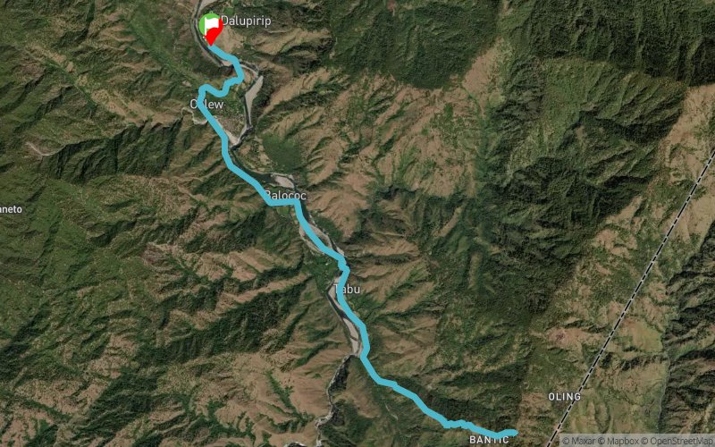
Itogon (PH) Inconnu (PH)
Kilomètre effort
Plus longue montée
Plus longue descente
39
890 m
900 m
Altitude max
Altitude min
Indice de qualité
1178 m
351 m
 1pt/7m
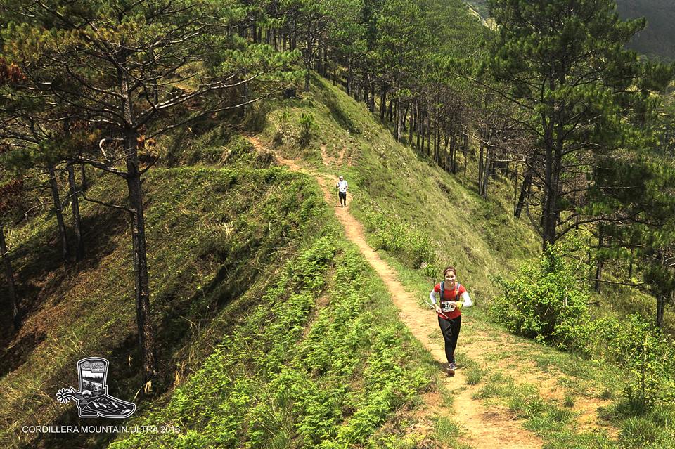
The 21KM Mountain Run goes up to a ridge in the village of Bantik that overlooks the entire Agno River Valley, as well as the Cagayan Valley and the Western Coastline of Norther Luzon and the West Philippine Sea before it turns back to the starting line.
The course will pass through 3 long hanging bridges across the Agno River
Distance: 21kms
D+: 1023m
D-: 1023m
En voir plus... En voir moins...

Départ
Distance
0 km
Altitude
398 m
D+
0 m
D-
0 m
24.1 km
1490 m
1480 m
Arrivée
Distance
24.1 km
Altitude
398 m
D+
1490 m
D-
1480 m
Cliquez sur un point d'intérêt pour l'afficher sur la carte
Avis et chronos
Ajouter une trace
Cordillera Mountain Ultra 2017 - 21K Mountain Run

Numéro de trace : 28017
Lien vers la trace :
https://tracedetrail.fr/fr/trace/28017
Connectez-vous pour insérer cette trace sur votre site web
 Trace de Trail