
 158.09 km
8001 m
8001 m
158.09 km
8001 m
8001 m

 1pt/10m
For the 10th iteration of the Pong Yaeng Trail, we bring back the longest-distance race, the PYT160.
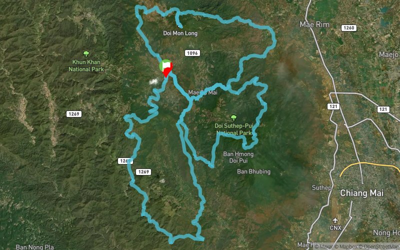
2024 PYT will be starting from Ai Na Ra Farm near Pong Yaeng Sub-district Office, just off the road No.1096.
The route will first take you eastward out of the Pong Yaeng area to Mae Sa Mai village and spiral down quickly through a mixture of deciduous and pine forests just below Mae Sa Waterfall, the lowest part of the entire route at around 400m AMSL.
Then, it hooks north to the foothill of Mon Hlong before ascending via the famous Rock Tower Climb to the summit of Mon Hlong itself 10km later.
Continuing on the road and farm tracks heading West, Pong Krai village awaits. The route pitches down very quickly to bring you back firmly into Pong Yaeng Valley.
The next part of the challenge for PYT160 is the Doi Pui Circuit (DPC), where climbs are long, with both ups and downs.
The final part is the Nin Prapa Trail (NPT)—the Southern Loop or the River Loop. As both names suggest, you will follow the course of streams and rivers to the very bottom and Southernmost of the route before climbing back up slowly to where you started.


 Trace de Trail