
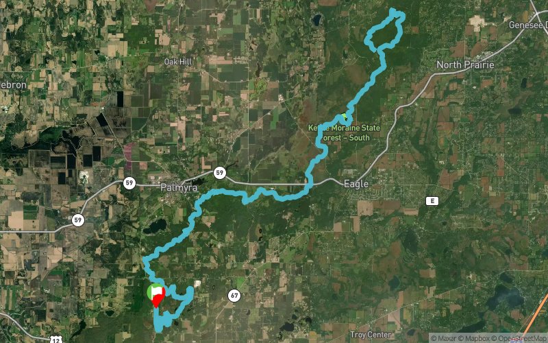
Kettle Moraine 100 2016 - 100 km
ITRA
 100.9 km
1500 m
1500 m
100.9 km
1500 m
1500 m


J'aime
Favoris
Avis
Partager
GPX
29
PDF A4
PDF A0
Profil
Flyover
3D
Insérer
Passages
Whitewater (US) Inconnu (US)
Kilomètre effort
Plus longue montée
Plus longue descente
115
100 m
100 m
Altitude max
Altitude min
Indice de qualité
337 m
232 m
 1pt/11m
The 100 km course will run entirely on trails (except for a couple hundred feet of road crossings) and will traverse the Ice Age National Scenic Trail (IANST) for about 40 miles. The runners deviate from the IANST when near the Nordic Trails at the start/finish and also near the Scuppernong turn around between miles 27-35. The event starts and finishes at the Nordic parking lot. All races start at 6am Saturday morning, except for the 50k and fun run which start Saturday afternoon at various times.
You will find the trail to be about 80% wooded terrain; with the rest meandering through gentle prairie or marsh areas. Part of the course will be a roller coaster of hills, with small rocks and roots scattered about. Other sections will be gently rolling with relatively smooth running surfaces. The pine sections give you that soft bed of pine needles that so many of us love to run on. Though our hills are not especially long or steep, they can take a tremendous toll on you if you attempt to run them. They are many and scattered throughout the course. "Silent Killers" is what one local runner calls them.
En voir plus... En voir moins...
Trace créée par Kettle Moraine 100 Endurance Runs
le 26/04/2016
le 26/04/2016

Départ
Distance
0 km
Altitude
318 m
D+
0 m
D-
0 m
100.9 km
1500 m
1500 m
Arrivée
Distance
100.9 km
Altitude
318 m
D+
1500 m
D-
1500 m
Cliquez sur un point d'intérêt pour l'afficher sur la carte
Avis et chronos
Ajouter une trace
Kettle Moraine 100 2016 - 100 km

Numéro de trace : 20942
Lien vers la trace :
https://tracedetrail.fr/fr/trace/20942
Connectez-vous pour insérer cette trace sur votre site web
 Trace de Trail