
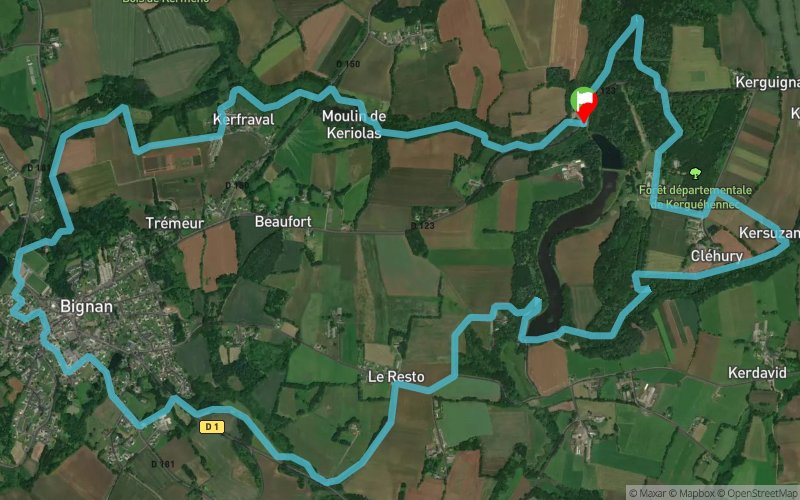
Circuit 90 bleu - Boucle du Château de Kerguéhennec
ESPACE TRAIL ROUTE
 13.9 km
240 m
240 m
13.9 km
240 m
240 m
Like
Favorites
Reviews
Share
GPX
285
PDF A4
PDF A0
Profile
Flyover
3D
Insert
Passages
Bignan (56) Bignan (56)
Effort kilometer
Longest ascent
Longest descent
16
60 m
50 m
Max. elevation
Min. elevation
Quality index
126 m
71 m
-
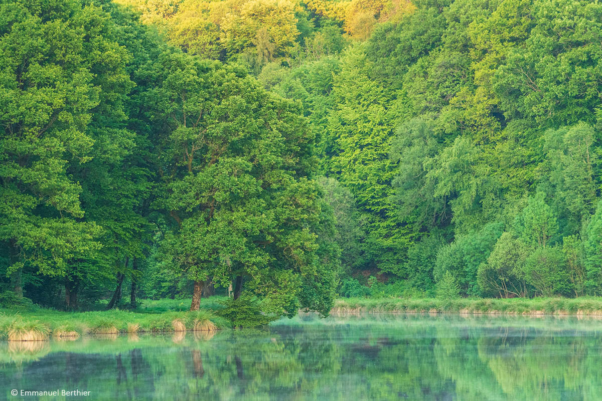
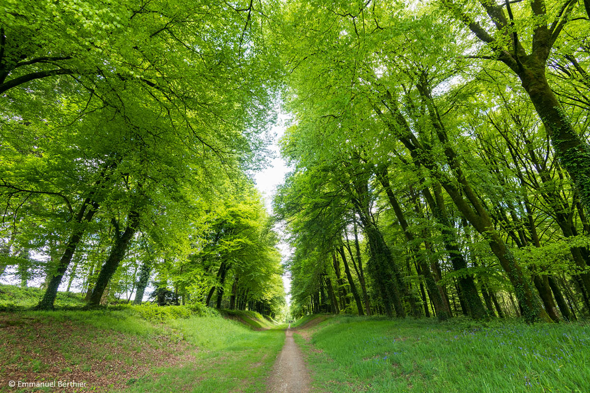
Ce circuit vous mènera dans une succession de sentiers monotraces et chemins creux à la découverte du magnifique vallon de Keriolas, du village de Bignan et du cadre exceptionnel du château et du parc de Kerguéhennec et de son étang.
Attention : Afin de limiter l'impact du balisage, ce parcours n'est pas balisé spécifiquement trail. Suivre le balisage randonnée jaune "circuit de Kerguéhennec".
Attention : Afin de limiter l'impact du balisage, ce parcours n'est pas balisé spécifiquement trail. Suivre le balisage randonnée jaune "circuit de Kerguéhennec".
En voir plus... En voir moins...
Track created by Coeur de Bretagne Destination Trail
le 2019/09/07 (modified on 2021/06/09)
le 2019/09/07 (modified on 2021/06/09)


Parking de la salle des sports
Distance
0 km
Altitude
122 m
D+
0 m
D-
0 m
2.6 km
30 m
47 m
Le Resto
Distance
2.6 km
Altitude
105 m
D+
30 m
D-
47 m
2.4 km
33 m
44 m
Sculptures permanentes
Distance
4.9 km
Altitude
94 m
D+
63 m
D-
91 m
0.9 km
14 m
8 m
Chapelle Kersuzan
Distance
5.8 km
Altitude
100 m
D+
77 m
D-
99 m
0.9 km
14 m
21 m
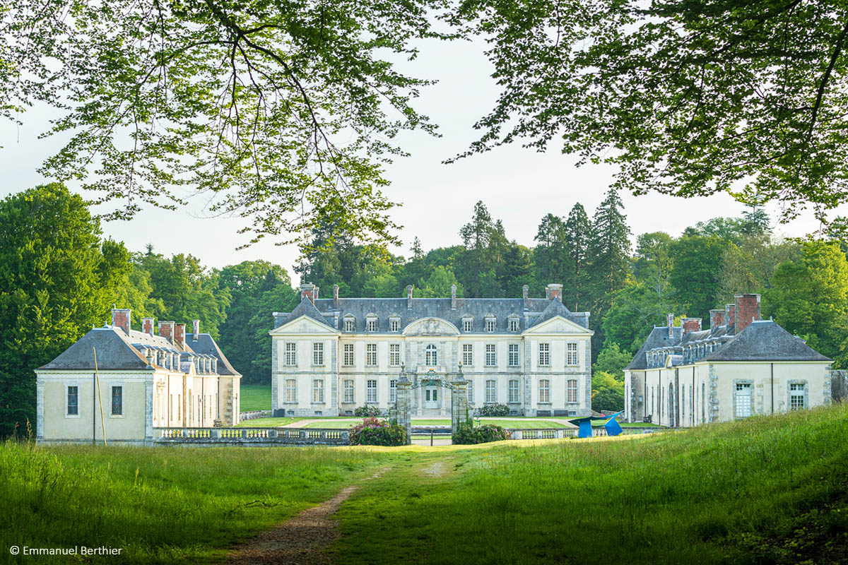
Château de Kerguéhennec
Distance
6.7 km
Altitude
93 m
D+
91 m
D-
120 m
3 km
51 m
64 m
Ruisseau de Keriolas
Distance
9.7 km
Altitude
80 m
D+
142 m
D-
184 m
4.2 km
91 m
46 m
Bignan
Distance
13.8 km
Altitude
125 m
D+
233 m
D-
230 m
0.05 km
7 m
10 m
Finish
Distance
13.9 km
Altitude
122 m
D+
240 m
D-
240 m
Click on a point of interest to display it on the map
Reviews and times
Add a track
Circuit 90 bleu - Boucle du Château de Kerguéhennec

Track number : 96575
Link to track :
https://tracedetrail.fr/en/trace/96575
Log in to insert this track on your website
 Trace de Trail