
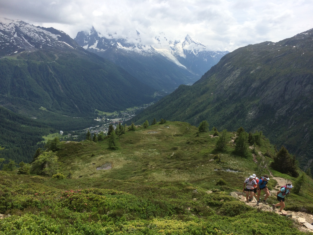
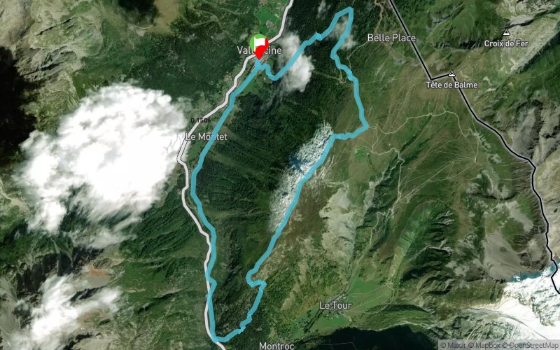
Col des Montets - Aiguillette des Posettes
SELECTED ROUTE
 14 km
963 m
963 m
14 km
963 m
963 m
GPX
227
PDF
Profile
Share
3D
Favorites
Reviews
Like
1
Vallorcine (74) Vallorcine (74)
Waytypes
Effort kilometer
Longest ascent
Longest descent
23
940 m
970 m
Max. elevation
Min. elevation
Quality index
2194 m
1258 m
 1pt/7m


Start
Distance
0 km
Altitude
1258 m
D+
0 m
D-
0 m
5.7 km
934 m
0 m
Aiguillette des Posettes
Distance
5.7 km
Altitude
2194 m
D+
934 m
D-
0 m
Peak
4.4 km
29 m
763 m
Col des Montets
Distance
10.2 km
Altitude
1458 m
D+
963 m
D-
763 m
3.7 km
0 m
200 m
Finish
Distance
14 km
Altitude
1258 m
D+
963 m
D-
963 m
Click on a point of interest to display it on the map
Reviews and times
Add a track
Col des Montets - Aiguillette des Posettes

Track number : 9573
Link to track :
https://tracedetrail.fr/en/trace/9573
Log in to insert this track on your website
 Trace de Trail