
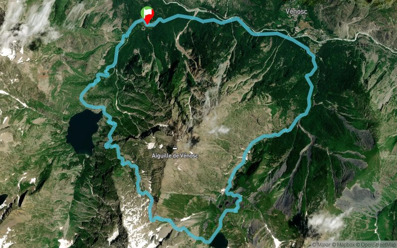
Tour lac de la Muzelle - lac du Lauvitel
SELECTED ROUTE
 20.62 km
1776 m
1776 m
20.62 km
1776 m
1776 m
GPX
212
PDF
Profile
Share
3D
Favorites
Reviews
1 Like
Vénosc (38) Vénosc (38)
Waytypes
Effort kilometer
Longest ascent
Longest descent
38
1650 m
1600 m
Max. elevation
Min. elevation
Quality index
2523 m
887 m
 1pt/10m
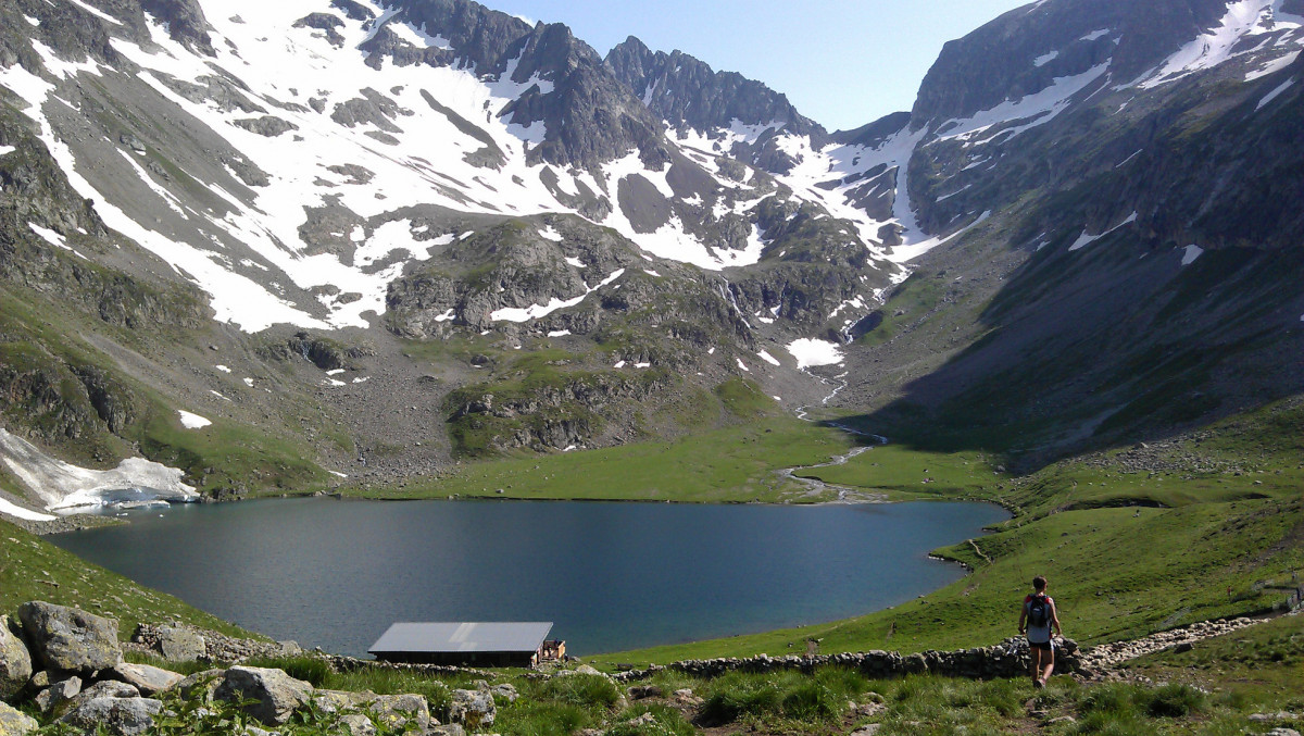
Très belle boucle qui passe par 2 lacs de montagne (lac de la Muzelle et lac du Lauvitel) et qui offre de superbes panoramas sur les sommets alentours.
La boucle commence par une portion plutôt plate - descendante jusqu'à Venosc. On remonte ensuite le vallon de la Muzelle jusqu'au refuge (+1200m). Au refuge, on longe lelac puis on le laisse sur notre gauche pour emprunter le sentier qui mène jusqu'au col du Vallon à 2500m d'altitude. Redescente ensuite sur le départ via le lac du Lauvitel.
Attention : se renseigner sur l'état d'enneigement du parcours avant d'y aller...
En voir plus... En voir moins...


La Danchère
Distance
0 km
Altitude
983 m
D+
0 m
D-
0 m
15.3 km
1723 m
1164 m
Distance
15.3 km
Altitude
1544 m
D+
1723 m
D-
1164 m
Lake
5.2 km
53 m
612 m
La Danchère
Distance
20.6 km
Altitude
983 m
D+
1776 m
D-
1776 m
La Denchère
Click on a point of interest to display it on the map
Reviews and times
megavarios262015/06/07
2015/06/07 04:00:00
2015/06/07 04:00:00
Un très beau trail avec des vues sur les montagnes magnifiques .
Par contre la descente sur le lac de Lauvitel est un peu cassante
Des névés versant ouest pas gênant.
Add a track
Tour lac de la Muzelle - lac du Lauvitel

Track number : 880
Link to track :
https://tracedetrail.fr/en/trace/880
Log in to insert this track on your website
 Trace de Trail