Show the map
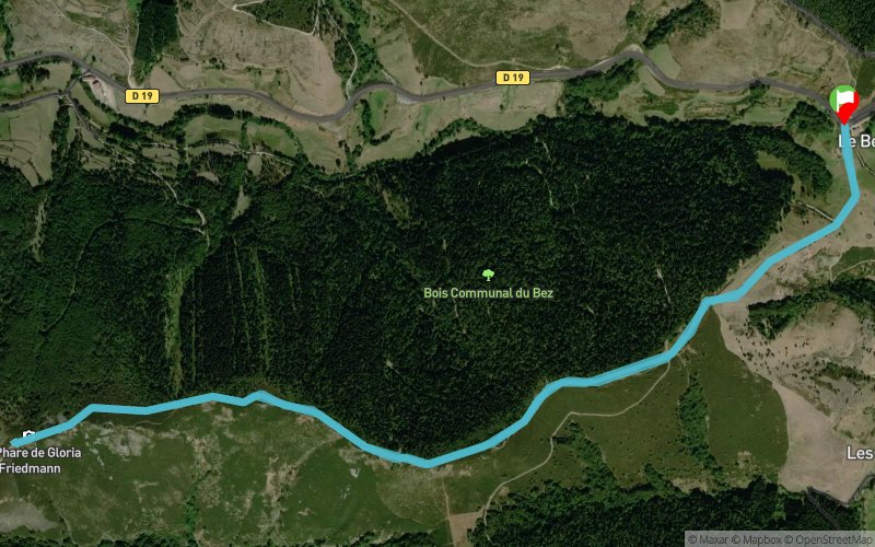
Le Bez - Moure de l'Abéouradou


6.7 km
350 m
350 m

Points of Interest table
Accum. | Intermediary | |||||||
---|---|---|---|---|---|---|---|---|
POI | Description | Alt. | Dist. | D+ | D- | Dist. | D+ | D- |
Trace n°87022
Ascent threshold : 3 m Distance threshold : 30 m Smoothing : No Origin of altitudes : MNT Aster GDEM
Loop
Dominant terrain : Path
Max alti. : 1358 m
Avg alti. : 1310 m
Min alti. : 1224 m
Longest ascent : 90 m
Longest descent : 90 m
Route completed by the author : No
Dominant terrain : Path
Max alti. : 1358 m
Avg alti. : 1310 m
Min alti. : 1224 m
Longest ascent : 90 m
Longest descent : 90 m
Route completed by the author : No
Elevation profile

Their last tracks
More tools
Create a new roadbook page
Carte à la Carte IGN
Map and track on your website
Warning ! When you insert a Trace de Trail map on your website, you agree not to hide any element of the module (links to Trail Trail or Trail Connect banner)
Add a realisation
Validate
Add a realisation to share your chrono and describe the conditions that you encountered during you trail running !
Add a comment
Validate
Nearby tracks
4.6 km Station de la Croix de Bauzon - Coucoulude - Col de Meyrand
9.8 km
330 m
330 m
Loubaresse (07)
4.6 km Croix de Bauzon - Sommet du Grand Tanargue - Col de Meyrand -Ron de Coucoulude
11.1 km
390 m
390 m
Loubaresse (07)
6.0 km Croix de Triousse - Sommet des Moles - St-Mélany - La Croix de Fer
28.7 km
910 m
1710 m
Loubaresse (07)
Show the infos
Add a track