
Ultra-Trail® Guaraní 2019 - 10K
ITRA
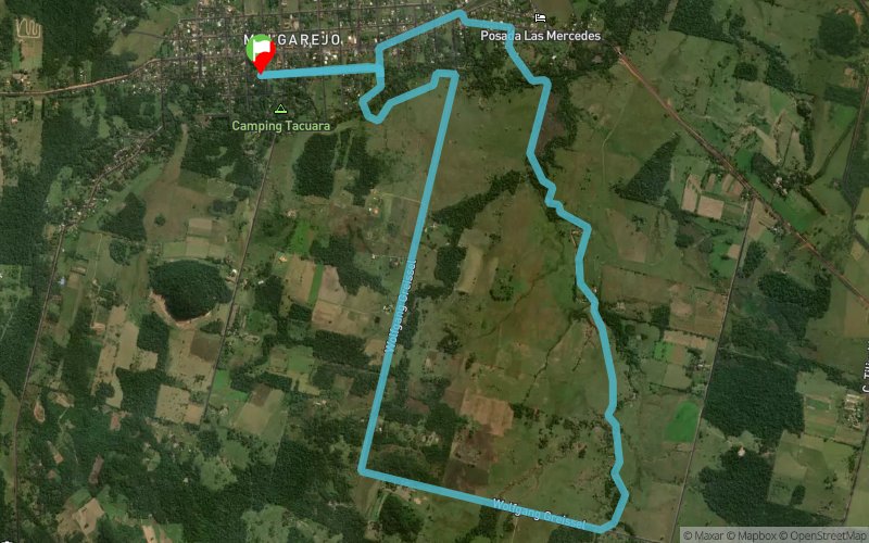
 11.5 km
140 m
140 m
11.5 km
140 m
140 m

09/06/2019
GPX
5
PDF
Profile
Share
3D
Favorites
Reviews
Like
Plaza de Melgarejo - Independencia, Guairá (ND) Plaza de Melgarejo - Independencia, Guairá (ND)
Effort kilometer
Longest ascent
Longest descent
12
50 m
80 m
Max. elevation
Min. elevation
Quality index
226 m
162 m
 1pt/11m
Ultra-Trail® Guaraní (UTG) es una carrera individual y non-stop, en plena naturaleza, por caminos y sendas que unen los cuatro senderos principales dentro de la Reserva de Recursos Manejados del Ybytyruzú (sendero rojo, sendero amarillo, sendero naranja y el sendero azul), que cuenta con distancias para todos los perfiles de atletas: desde debutantes en trail running y corredores de media distancia hasta ultramaratonistas experimentados en largas distancias y desniveles.
UTG es sinonimo de una naturaleza incomparable. La impresionante Cordillera del Ybytyruzú (en castellano) o Yvytyrusu (en guaraní) está constituida por una serie de serranías situadas entre los departamentos del Guairá y Caazapá de la República del Paraguay. Actualmente es una de las principales áreas de conservación de la región oriental del país y alberga tanto el pico más alto (Cerro Tres Kandú con 842 msnm) como también uno de los saltos de agua más elevados, el Salto Suizo, de 40 metros de altura.
Las distancias son las siguientes: 10, 22, 50 y 100 kilómetros.
La línea de largada para todas las distancias será la Plaza Ybytyruzu de la ciudad de Melgarejo, en el distrito de Independencia en el departamento del Guairá a 27 kilómetros de su capital Villarrica.
El evento será realizado el día sábado 8 y domingo 9 de junio de 2019.
En voir plus... En voir moins...


Plaza de Melgarejo - Independencia, Guairá
Distance
0 km
Altitude
180 m
D+
0 m
D-
0 m
5.9 km
88 m
85 m
PAS Cerro León
Distance
5.9 km
Altitude
182 m
D+
88 m
D-
85 m
5.5 km
52 m
55 m
Finish
Distance
11.5 km
Altitude
180 m
D+
140 m
D-
140 m
Click on a point of interest to display it on the map
Reviews and times
Add a track
Ultra-Trail® Guaraní 2019 - 10K

Track number : 86887
Link to track :
https://tracedetrail.fr/en/trace/86887
Log in to insert this track on your website
 Trace de Trail