
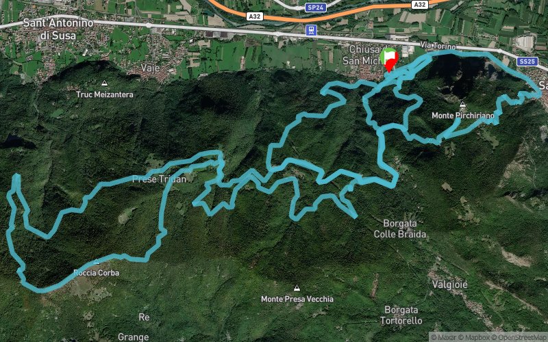
Valsusa Trail 2019 - 43 km
 42.8 km
2700 m
2690 m
42.8 km
2700 m
2690 m
02/06/2019
GPX
7
PDF
Profile
Share
3D
Favorites
Reviews
Like
Chiusa Di San Michele (IT) Chiusa Di San Michele (IT)
Effort kilometer
Longest ascent
Longest descent
69
610 m
640 m
Max. elevation
Min. elevation
Quality index
1482 m
354 m
 1pt/9m
Start
Distance
0 km
Altitude
373 m
D+
0 m
D-
0 m
42.8 km
2700 m
2690 m
Finish
Distance
42.8 km
Altitude
373 m
D+
2700 m
D-
2690 m
Click on a point of interest to display it on the map
Reviews and times
Add a track
Valsusa Trail 2019 - 43 km

Track number : 85139
Link to track :
https://tracedetrail.fr/en/trace/85139
Log in to insert this track on your website
 Trace de Trail