
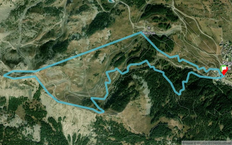
Aiguilles Trail de Serre-Ponçon 2019 - KV Up & Down
 5.7 km
600 m
600 m
5.7 km
600 m
600 m
22/06/2019
GPX
32
PDF
Profile
Share
3D
Favorites
Reviews
Like
Réallon (05) Réallon (05)
Effort kilometer
Longest ascent
Longest descent
11
590 m
600 m
Max. elevation
Min. elevation
Quality index
2137 m
1546 m
 1pt/60m
Track created by Arthur Cerqueira
le 2019/03/14 (modified on 2019/04/27)
le 2019/03/14 (modified on 2019/04/27)

Start
Distance
0 km
Altitude
1546 m
D+
0 m
D-
0 m
5.7 km
600 m
600 m
Finish
Distance
5.7 km
Altitude
1546 m
D+
600 m
D-
600 m
Click on a point of interest to display it on the map
Reviews and times
Add a track
Aiguilles Trail de Serre-Ponçon 2019 - KV Up & Down

Track number : 81861
Link to track :
https://tracedetrail.fr/en/trace/81861
Log in to insert this track on your website
 Trace de Trail