
Geyik Kosulari 4K
ROUTE TESTED BY THE AUTHOR
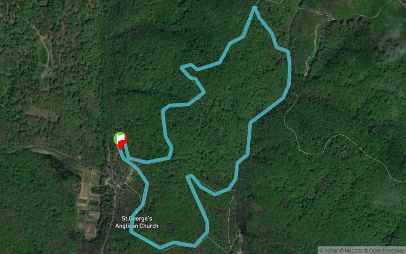
 4.3 km
170 m
170 m
4.3 km
170 m
170 m
GPX
73
PDF
Profile
Share
3D
Favorites
Reviews
Like
Bahçeköy (TR) Bahçeköy (TR)
Effort kilometer
Longest ascent
Longest descent
6
90 m
90 m
Max. elevation
Min. elevation
Quality index
186 m
97 m
 1pt/12m
Start
Distance
0 km
Altitude
99 m
D+
0 m
D-
0 m
4.3 km
170 m
170 m
Finish
Distance
4.3 km
Altitude
99 m
D+
170 m
D-
170 m
Click on a point of interest to display it on the map
Reviews and times
Add a track
Geyik Kosulari 4K

Track number : 79438
Link to track :
https://tracedetrail.fr/en/trace/79438
Log in to insert this track on your website
 Trace de Trail