
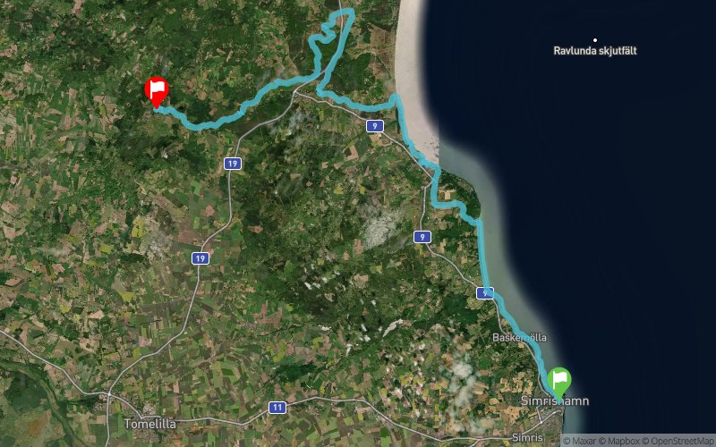
Simris Alg Ultra 2019 - 60K
ITRA
 58.7 km
860 m
740 m
58.7 km
860 m
740 m

GPX
10
PDF
Profile
Share
3D
Favorites
Reviews
Like
Simrishamn (SE) Lövestad (SE)
Effort kilometer
Longest ascent
Longest descent
67
220 m
110 m
Max. elevation
Min. elevation
Quality index
124 m
0 m
 1pt/14m
A fantastic adventure on the wildest part of Österlen. Discover the best of the regions unique nature. The course goes straight through Stenshuvuds national parc and six others nature reserve but also historical buildings. The variation of the terrain and the landscape gives a unique feeling to the race. Trail running at its best!

Start
Distance
0 km
Altitude
4 m
D+
0 m
D-
0 m
58.7 km
851 m
736 m
Finish
Distance
58.7 km
Altitude
119 m
D+
851 m
D-
736 m
Click on a point of interest to display it on the map
Reviews and times
Add a track
Simris Alg Ultra 2019 - 60K

Track number : 69381
Link to track :
https://tracedetrail.fr/en/trace/69381
Log in to insert this track on your website
 Trace de Trail