
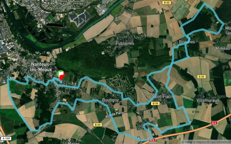
Boutigny - Montceaux-les-Meaux - St-Fiacre - Prévilliers
 28 km
630 m
630 m
28 km
630 m
630 m
GPX
5
PDF
Profile
Share
3D
Favorites
Reviews
Like
Nanteuil-lès-Meaux (77) Nanteuil-lès-Meaux (77)
Effort kilometer
Longest ascent
Longest descent
34
80 m
100 m
Max. elevation
Min. elevation
Quality index
166 m
55 m
 1pt/5m
Start
Distance
0 km
Altitude
85 m
D+
0 m
D-
0 m
28 km
630 m
630 m
Finish
Distance
28 km
Altitude
85 m
D+
630 m
D-
630 m
Click on a point of interest to display it on the map
Reviews and times
Add a track
Boutigny - Montceaux-les-Meaux - St-Fiacre - Prévilliers

Track number : 55110
Link to track :
https://tracedetrail.fr/en/trace/55110
Log in to insert this track on your website
 Trace de Trail