
Trail des Goyaves 2018
 26.1 km
1620 m
1160 m
26.1 km
1620 m
1160 m
07/04/2018
GPX
6
PDF
Profile
Share
3D
Favorites
Reviews
Like
Inconnu (MU) Inconnu (MU)
Effort kilometer
Longest ascent
Longest descent
42
620 m
540 m
Max. elevation
Min. elevation
Quality index
763 m
109 m
 1pt/10m
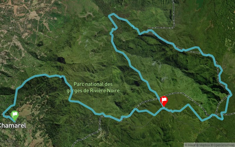
Start in Chamarel village, 600m of road before climbing to the highest point of Mauritius, Piton de la Riviere Noire on technical singletrack, then turn along the crest of the ridge to Plaine Champagne 3km distance, to the viewpoint on more singeltracks, then a track to the Parakeet antenna on 1km of road, turning onto more narrow singletrack crossing rivers and small descents and climbs, into a pine forest with track, until Petrin where there is a vechicle track leading ot the top of the Black River Gorges, going down into the valley on slippery mud path and crossing the main river at 100m altitude, then a climb back up the steepest path in Mauritius to the Parakeet Antenna.
En voir plus... En voir moins...

Start
Distance
0 km
Altitude
281 m
D+
0 m
D-
0 m
26.1 km
1616 m
1157 m
Finish
Distance
26.1 km
Altitude
741 m
D+
1616 m
D-
1157 m
Click on a point of interest to display it on the map
Reviews and times
Add a track
Trail des Goyaves 2018

Track number : 50272
Link to track :
https://tracedetrail.fr/en/trace/50272
Log in to insert this track on your website
 Trace de Trail