
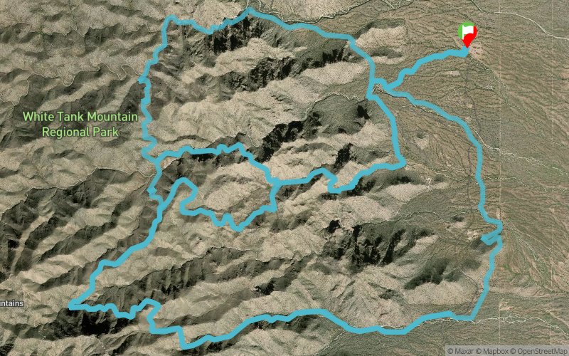
Mesquite Canyon 2018 - 50 Miles
ITRA
 74.1 km
2040 m
2040 m
74.1 km
2040 m
2040 m


GPX
7
PDF
Profile
Share
3D
Favorites
Reviews
Like
Waddell (US) ()
Effort kilometer
Longest ascent
Longest descent
94
570 m
530 m
Max. elevation
Min. elevation
Quality index
985 m
433 m
 1pt/14m
All runs take place on single track trails within White Tank Mountain Regional Park. Expect typical desert trail conditions including rocks, sand, cactus and gravel.
50 mile runners will travel through a two mile section of wash in Ford Canyon featuring several downhill granite rock scrambles, sand and boulders.

Start
Distance
0 km
Altitude
458 m
D+
0 m
D-
0 m
74.1 km
2040 m
2040 m
Finish
Distance
74.1 km
Altitude
458 m
D+
2040 m
D-
2040 m
Click on a point of interest to display it on the map
Reviews and times
Add a track
Mesquite Canyon 2018 - 50 Miles

Track number : 45969
Link to track :
https://tracedetrail.fr/en/trace/45969
Log in to insert this track on your website
 Trace de Trail