Show the map
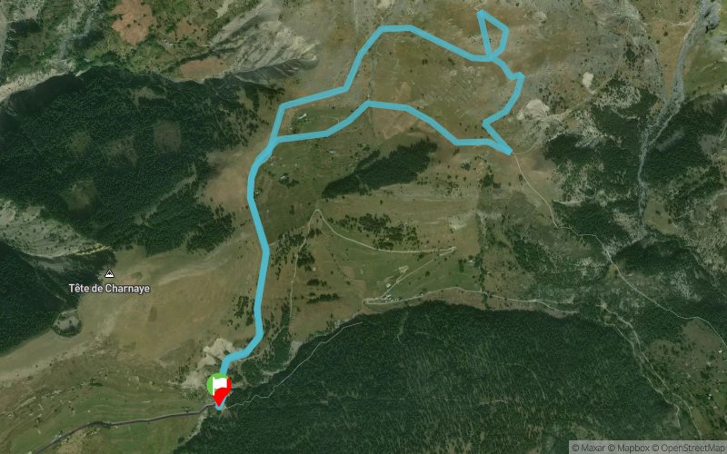
Col de l'Espaul - La Colle


5.7 km
290 m
280 m

Points of Interest table
Accum. | Intermediary | |||||||
---|---|---|---|---|---|---|---|---|
POI | Description | Alt. | Dist. | D+ | D- | Dist. | D+ | D- |
Trace n°39563
Ascent threshold : 3 m Distance threshold : 30 m Smoothing : Yes Origin of altitudes : MNT Aster GDEM
Loop
Dominant terrain : Path
Max alti. : 2003 m
Avg alti. : 1823 m
Min alti. : 1748 m
Longest ascent : 280 m
Longest descent : 260 m
Route completed by the author : nc
Dominant terrain : Path
Max alti. : 2003 m
Avg alti. : 1823 m
Min alti. : 1748 m
Longest ascent : 280 m
Longest descent : 260 m
Route completed by the author : nc
Elevation profile
Their last tracks
Maison forestière du Malpey - Mont Vinaigre - Col de l'Aire de l'Olivier
8.4 km
390 m
390 m
Les Adrets-de-l'Estérel (83)
Col de Belle Barbe - Col du Baladou - Col du Perthus - Col du Mistral
6.5 km
240 m
240 m
Théoule-sur-Mer (06)
Col de Belle Barbe - Col de Baladou - Maison Forestière du Gratadis
7.7 km
230 m
230 m
Théoule-sur-Mer (06)
Maison Forestière de Roussivau - Baisse des Charretiers - Baisse Andoulette
8.6 km
320 m
320 m
Les Adrets-de-l'Estérel (83)
More tools
Create a new roadbook page
Carte à la Carte IGN
Map and track on your website
Warning ! When you insert a Trace de Trail map on your website, you agree not to hide any element of the module (links to Trail Trail or Trail Connect banner)
Add a realisation
Validate
Add a realisation to share your chrono and describe the conditions that you encountered during you trail running !
Add a comment
Validate
Nearby tracks
0.0 km Col de l'Espault - La Colle - Le Petit Mounier - Mont mounier
17.8 km
1167 m
1171 m
Beuil (06)
Show the infos
Add a track