Show the map
OFFICIAL ROUTE
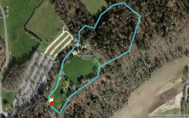
LG Trail 2017 - LG Kids


1 km
40 m
40 m

Points of Interest table
Accum. | Intermediary | |||||||
---|---|---|---|---|---|---|---|---|
POI | Description | Alt. | Dist. | D+ | D- | Dist. | D+ | D- |

Trace n°39317
Ascent threshold : 3 m Distance threshold : 0 m Smoothing : No Origin of altitudes : GPS
Loop
Dominant terrain : Footpath
Max alti. : 719 m
Avg alti. : 720 m
Min alti. : 695 m
Longest ascent : 20 m
Longest descent : 40 m
Dominant terrain : Footpath
Max alti. : 719 m
Avg alti. : 720 m
Min alti. : 695 m
Longest ascent : 20 m
Longest descent : 40 m
Elevation profile

Their last tracks
LG Trail 2019 - Lausanne Genève - LG Relais 2 - 2ème partie - 53 km
52.6 km
1600 m
2270 m
Saint-Cergue (CH)
LG Trail 2019 - Lausanne Genève - LG Relais 2 - 1ère partie - 66 km
66.4 km
2310 m
1650 m
Lausanne (CH)
More tools
Create a new roadbook page
Carte à la Carte IGN
Map and track on your website
Warning ! When you insert a Trace de Trail map on your website, you agree not to hide any element of the module (links to Trail Trail or Trail Connect banner)
Add a realisation
Validate
Add a realisation to share your chrono and describe the conditions that you encountered during you trail running !
Add a comment
Validate
Nearby tracks
22.3 km Lac Léman - Portes d'Oche - Col de Coux - Samoëns - Col d'Anterne - Le Brévent
129 km
7950 m
7340 m
Thonon-les-Bains (74)
Show the infos
Add a track