
The Hillary 2018 - 80 km
ITRA
 77.3 km
3370 m
3560 m
77.3 km
3370 m
3560 m


GPX
10
PDF
Profile
Share
3D
Favorites
Reviews
Like
Huia (NZ) Woodhill (NZ)
Effort kilometer
Longest ascent
Longest descent
111
400 m
330 m
Max. elevation
Min. elevation
Quality index
411 m
17 m
 1pt/11m
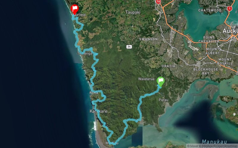
The Full Hillary trail 80km Ultra SkyMarathon (solo or relay of 2-4 people) follows a variety of terrain and scenery. Stunning views throughout the trail, rugged West coast beaches, magnificent native bush including the hundreds of year old native Kauri trees. Past large waterfalls and sand dunes, along cliff tops or through marshlands – there is something for everyone. Come along and “Knock The Bugger off!”
En voir plus... En voir moins...

Start
Distance
0 km
Altitude
219 m
D+
0 m
D-
0 m
77.3 km
3367 m
3551 m
Finish
Distance
77.3 km
Altitude
36 m
D+
3367 m
D-
3551 m
Click on a point of interest to display it on the map
Reviews and times
Add a track
The Hillary 2018 - 80 km

Track number : 37883
Link to track :
https://tracedetrail.fr/en/trace/37883
Log in to insert this track on your website
 Trace de Trail