
Ultra Del Chaski - Apurimac - Choquequirao - Machu Picchu
 114.7 km
8380 m
9220 m
114.7 km
8380 m
9220 m
GPX
48
PDF
Profile
Share
3D
Favorites
Reviews
Like
Inconnu (ND) Inconnu (ND)
Effort kilometer
Longest ascent
Longest descent
198
2540 m
3470 m
Max. elevation
Min. elevation
Quality index
4647 m
1478 m
 1pt/46m
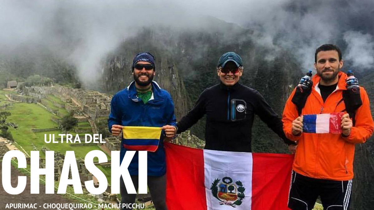
Projet personnel avec deux amis du team #UltraChaskis: Rejoindre l'Apurimac à Machu Picchu PEROU en utilisant les chemins Incas passant par plusieurs sites archéologiques à couper le souffle (la ligne d'arrivée étant le Machu Picchu). D+7800m, deux sommets à 4170m et 4700m. 115km de dure montagne et d'aventure en autonomie totale en mode "survie", portant tout notre équipement et nourriture dans nos sacs. Le froid, la pluie, de la boue jusqu'aux chevilles, de la neige, des éboulements et des paysages extraordinaires.
Une aventure incroyable!!!
Vidéo: https://www.facebook.com/UltraChaskis/videos/419125355129576/
En voir plus... En voir moins...

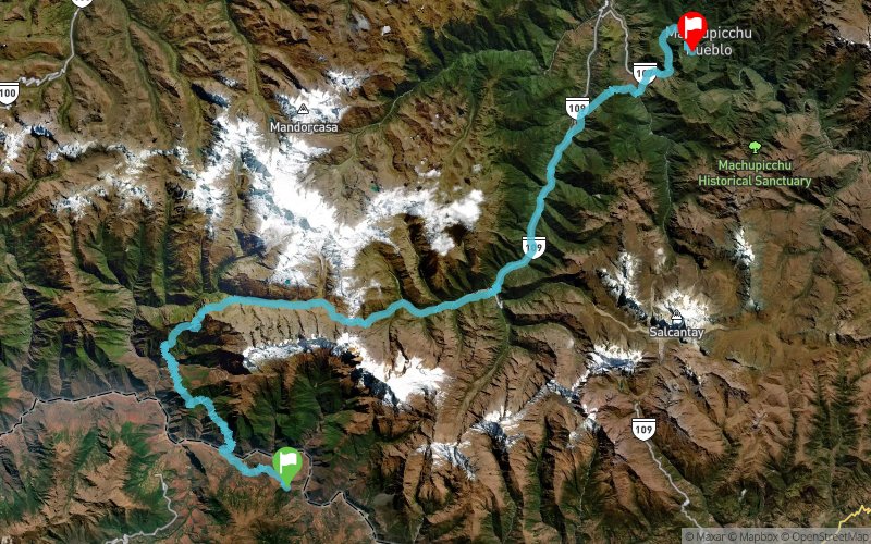
Mirador de Capuliyoc
Distance
0 km
Altitude
2871 m
D+
0 m
D-
0 m
114.7 km
8373 m
9219 m
Machu Picchu
Distance
114.7 km
Altitude
2013 m
D+
8373 m
D-
9219 m
Click on a point of interest to display it on the map
Reviews and times
Add a track
Ultra Del Chaski - Apurimac - Choquequirao - Machu Picchu

Track number : 37368
Link to track :
https://tracedetrail.fr/en/trace/37368
Log in to insert this track on your website
 Trace de Trail