
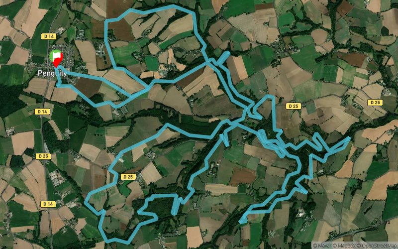
Penguily - Le Moulin Tison - La Bretonnière
 27.3 km
670 m
680 m
27.3 km
670 m
680 m
GPX
14
PDF
Profile
Share
3D
Favorites
Reviews
Like
La Malhoure (22) La Malhoure (22)
Effort kilometer
Longest ascent
Longest descent
34
90 m
90 m
Max. elevation
Min. elevation
Quality index
159 m
70 m
 1pt/4m
Start
Distance
0 km
Altitude
154 m
D+
0 m
D-
0 m
27.3 km
670 m
680 m
Finish
Distance
27.3 km
Altitude
154 m
D+
670 m
D-
680 m
Click on a point of interest to display it on the map
Reviews and times
Add a track
Penguily - Le Moulin Tison - La Bretonnière

Track number : 35922
Link to track :
https://tracedetrail.fr/en/trace/35922
Log in to insert this track on your website
 Trace de Trail