
Whistler Alpine Meadows 2017 - 50K
ITRA
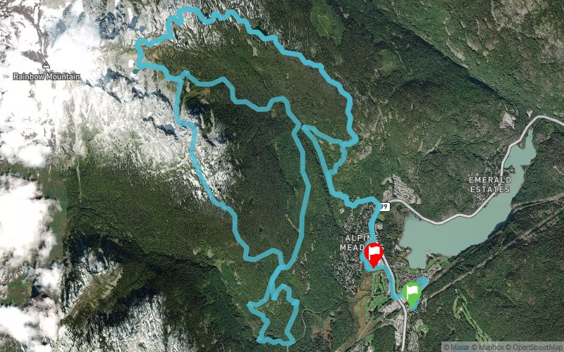
 53.8 km
3150 m
3170 m
53.8 km
3150 m
3170 m

GPX
25
PDF
Profile
Share
3D
Favorites
Reviews
Like
North Island, Sunshine Coast, and Southern Gulf Islands (Whistler) (CA) North Island, Sunshine Coast, and Southern Gulf Islands (Whistler) (CA)
Effort kilometer
Longest ascent
Longest descent
85
1340 m
1180 m
Max. elevation
Min. elevation
Quality index
1798 m
621 m
 1pt/7m
Start
Distance
0 km
Altitude
644 m
D+
0 m
D-
0 m
53.8 km
3147 m
3170 m
Finish
Distance
53.8 km
Altitude
621 m
D+
3147 m
D-
3170 m
Click on a point of interest to display it on the map
Reviews and times
Add a track
Whistler Alpine Meadows 2017 - 50K

Track number : 30118
Link to track :
https://tracedetrail.fr/en/trace/30118
Log in to insert this track on your website
 Trace de Trail